|
|
|
Bikepaths and Greenways |
|
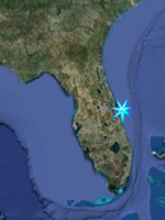
Space Coast South
|
|
Back to Biking Home |
|
These sites all have improved biking and
walking surfaces for either ease of
walking, wheelchair use, provide access
to otherwise inaccessible habitats, or
to protect sensitive environments and
vegetation. |
|
Mainland
|
|
Jump Menu
Beachside
|
Fred Poppe Regional Park
1951 Malabar Road NW, Palm Bay
FROM I-95 Exit-173 take SR-514-Malabar
Road west 6 miles and turn right into
the park road.
Open after 7:00 a.m. until dark, except
for scheduled use.
Four lakes for fishing, viewing
wildlife, some pine flatwood forest on
property. Sightings include deer,
turkey, alligator, snake, duck, sandhill
crane, owl, migratory songbirds, and
others.
Facilities include athletic fields,
basketball and volleyball courts,
restrooms, picnic area, playground,
pavilion with 3 grills, bicycle/walking
trail and fishing deck.
Park Map
GPS N 28 00.455 W 80 43.987
Google Satellite Image |
|
Boundary Canal Trail and
Sand Hill Trail
Palm Bay / Malabar
The Boundary Canal Trail can be accessed
from the bikepath along Port Malabar
Blvd east of the Turkey Creek Sanctuary
If arriving by car, park at
Turkey Creek Sanctuary, ride
east on Port Malabar Blvd. about .6
miles. When you cross a small bridge
over Turkey Creek the next right turn
will be Briar Creek Road. Just past
Briar creek road look for the entrance
to the trail on the right. The path
starts south along a canal then follows
the canal as it turns to the east and
allows MTB access to the Cameron
Preserve and the Malabar Scrub Sanctuary
on the south side. At the eastern end of
the trail it connects to the Sand Hill
Trail heading south along the Malabar
Sanctuary to Malabar Road. Eventually it
will connect to the South Brevard Linear
trail (proposed) and the Jordan Scrub
Sanctuary.
Biking, jogging, rollerblading, hiking,
equestrian use and mountain biking are
all accommodated by the Boundary Canal
Trail.
Malabar / Palm Bay Trails Map
(Boundary Canal trail in Green)
GPS for Parking at Turkey Creek
Sanctuary N 28 01.016 W 80 36.289
Turkey Creek Entrance Google Satellite
Image
GPS Malabar Entrance to Boundary Canal
Trail N 28 00.917 W 80 35.625
Boundary Canal Trail Entrance Google
Satellite Image
|
|
|
|
|
State Road A1A Trail
A forty mile long multi-use, paved path
along A1A from Indialantic past
Sebastian Inlet to Vero Beach. Access
both several beachside spots as well as
those along the lagoon. Note: There is
no path across the bridge at Sebastian
Inlet. Provides access to all of the
hiking locations listed on
Space Coast Outdoors Wilderness Hikes
South (scroll down to
beachside). |
Sebastain Inlet State Park
One of Florida's most popular state
parks, Sebastain Inlet is a mecca for
snook fishing and is easily located on
Highway A1A about 15 miles south of
Melbourne Beach. When you see the big
bridge, you are there. Sebastain Inlet
State Park has something for just about
everyone. There are hiking trails,
paved multiuse trails along the
shoreline of the inlet, mountain
bike trails, good snorkeling, diving,
great fishing, kayaking, boating, two
museums, and a great sand bottom shallow
swimming and wading lagoon. Don
snorkeling gear and swim along the rocks
separating the wading lagoon and the
inlet and you will see snapper,
sheepshead, and many other small fish
species. More experienced snorkelers and
divers can find good areas along the
rock walls of the inlet itself. (More
info on Space Coast Outdoors Snorkeling
page.) A boat ramp can be found on the
south side on the lagoon. There are two
museums on site. The McLarty Treasure
Museum tells the story about the
Spanish Treasure Fleet of 1715,
that wrecked along the Florida southeast
coast in that year. The El Capitan was
the northernmost shipwreck of the 11
ship fleet that was driven ashore by a
massive hurricane in July of 1715 and
broke apart on the shallow reefs within
a mile of the south jetty. All 11 ships
were lost and over 1,000 sailers died.
The museum is on the site of the
survivors of the El Capitan campground.
The Sebastian Fishing Museum tells the
history of the area's fishing industry.
Map of Sebastain Inlet State Park
GPS N 27 51.683 W 80 26.931
Google Satellite Image |
|
|
|
|