|
|
|
Mountain Bike Trails |
|
Space Coast Central |
|
Back to Biking Home |
|
This section includes destinations
for Mountain Bike Trails in Central Brevard County |
|
|
|
Jump
Menu
Merritt Island
|
| |
River Lakes Conservation Area
River lakes Conservation Area is part of
the
Upper St. John's River Marsh Wildlife
Management Area, and
encompasses 36,156 acres of the St johns
River Watershed from State Road 520 west of
Cocoa to State Road 192 west of Melbourne,
and includes lakes Poinsett, Winder and
Washington. The one biking access to the
property is the Mocassin Island Trail.
The trailhead is located at the very end of
Wickham Road in Melbourne. From the
trailhead you have a choice of riding to the
North or to the South. The north section is
about 2.5 miles and ultimately ends at an
observation point near Lake Winder. The
South section will take you 2.6 miles south
and west to the Oak Hammock Loop,
which is itself about 2 miles, near the St
John's River. Among the wildlife species
seen here are wood storks, bald eagles, and
many other species associated with the vast
wetlands. Portions of this trail system may
be seasonally flooded.
Property Map
Mocassin Island Trails Map
GPS N 28 13.797 W 80 48.644
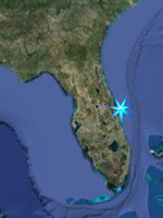
Google Satellite Image |
| |
Wickham Park
2500 Parkway Drive, Melbourne
321-255-4307
Wickam Park is a popular 391 acre park
with semi-improved camping, about four miles
of narrow trails that meander through oak
hammocks, scrub, pine flatwoods, and along
marshy streams for biking, equestrian, and
hiking use, a paved walking trail, two
unguarded swimming ponds, and several more
small ponds, equestrian facilities, and a
dog park. Some of the species sighted here
include Brownheaded Nuthatch, Bobwhite,
Painted Bunting, Chuck-will’s-widow, Raptor,
Killdeer, Migratory Songbirds.
Map
GPS N 28 09.471 W 80 39.802
Google Satellite Image |
| |
|
|
|
Jump
Menu
Back to Top
|
| |
Ulumay Wildlife Sanctuary
805 Sykes Creek Parkway, Merritt Island
FROM US Hwy 1 go 2.9 miles east on SR-520,
turn left and go about 0.5 miles on Sykes
Creek Parkway. The park entrance is on the
left.
Projecting into Sykes Creek at the southwest
corner of the park is a pier commonly known
as the Old Humpbacked Troll Bridge. There
are also dikes along the impoundment with
hiking and biking trails.
ADA ACCESSIBLE: Fishing Pier
Open after 7:00 a.m. until dark.
GPS N 28 22.317 W 80 40.426
Google Satellite Image |
|
|
|
|