Backcountry
Camping
Watercraft Access
Space Coast South |
|
|
| |
|
|
|
|
| |
Three Forks Marsh Conservation Area
The Three Forks Conservation Area
extends from State Road 192 west of
Melbourne southward to the Fellsmere
Grade, which forms the southern border
of Brevard County and Indian River
County and contains Three Forks Marsh,
within which three creeks come together
to form the first discernable channel of
the St. John's River. Camp Holly on
State Road 192 is the only clear kayak
access point to the Three Forks Area
allowing you to actually travel the
headwaters of the St. John's River.
Paddling south from here will take you
to Sawgrass lake, little Sawgrass lake,
then to Lake Hell N Blazes, and finally
to the Three forks that become the St.
Johns. This is an upstream paddle as the
St. John's flows to the north, but not
that difficult as the flow is very
"lazy" and it is well worth the paddle.
Of special interest to boaters and
kayakers are the 5 designated
campsites and camping platforms
within the Three Forks Area.
FFWCC Brochure
Property Map
Primitive campsites and platforms
Camping Rules Regulations and
Reservations
|
| |
| Note; These
campsites are designed primarily for airboat
access along airboat trails, and due to the
terrain most are located some distance from
the open water of the lakes and river.
During the rainy season you may be able to
reach some of them in a kayak via flooded
airboat trails, other times you will have to
either walk or may even find them impossible
to access without an airboat. The Google
Satellite image locations are based on
co-ordinates provided by the St. John's
River Water Management District, and may not
be depicted on Google with 100% accuracy.
|
|
Campsite
Links
|
Satellite
|
GPS
|
|
|
|
N 28
03.842
W 80 46.140
|
|
|
|
N 28
02.910
W 80 47.211
|
|
|
|
N 28
01.155
W 80 47.857
|
|
|
|
N 27
59.941
W 80 48.213
|
|
|
|
N 27
54.654
W 80 45.728
|
|
|
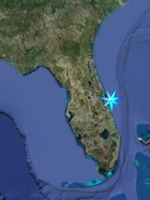
Put in site for Three Forks
Conservation Area
|
| |
Camp Holly;
This privately owned fish camp is located on
State Road 192 where it crosses the St.
Johns West of Melbourne. Features include
boat ramps, a bar, bait, tackle, boat
rentals, airboat rides, and live
entertainment. Putting in here provides
access to the
River Lakes Conservation Area to the
North, and
Three Forks Marsh Conservation Area
to the South.
Camp Holly Website
GPS N 28 05.105 W 80 45.110
Google Satellite Image |
| |
Blue Cypress Conservation Area
This area is part of the Upper St. Johns
River Basin Project being implemented by the
District and the U.S. Army Corps of
Engineers. This project will reduce
flooding, restore and maintain natural
hydrologic cycles and protect water quality.
It will also reduce freshwater diversions to
the Indian River Lagoon estuary and enhance
native habitat for fish and wildlife. Blue
Cypress Lake and Kenansville Lake are
located on the western portion of the area.
The eastern portion of the area contains
foraging and nesting habitat for the listed
snail kite. Wetland-dependent species found
here include great blue herons, white ibis,
snowy egrets, limpkins and night herons.
Other species include wood storks, ospreys
and bald eagles. There are three primary
locations for Paddling this area.
The Fellesmere Grade Recreation Pad
allows access to the Stick Farm Marsh 13
area. These areas are world reknowned for
their Bass fishing. The Stick Farm gets it's
name from the fact that it was once a
forest. It was flooded in order to create an
impoundment to treat water coming in from
the C-54 Canal before it could distribute
accumilated pollutants and nutrients to the
Upper St. John's Marsh, improving the water
quality of the River. This stump filled
marsh is a great place to paddle in the fall
and winter to see flocks of migratory ducks.
There is a campsite along the "Zig Zag
Canal. |
|
Stick
Farm / Marsh 13 Area
|
Satellite
|
GPS
|
|
Duck
Camp
|
|
N 27
45.273
W 80 43.316
|
|
Directions: From I-95 in Palm
Bay, take Exit 173 (Malabar Road)
and go 0.25 miles east to Babcock
Street (CR 507). Turn right and go
south on Babcock for approximately
11 miles. Turn right onto Fellsmere
Grade Road just after crossing the
C-54 Canal. From the intersection of
1-95 and CR 512 (Exit 156), head
west for three miles to CR 507
(Babcock Street). Turn right (north)
and, after five miles, turn left
(west) onto Fellsmere Grade Road,
just south of the C-54 Canal. Go all
the way to the end of the dirt road
(about six miles).
Fellsmere Grade Recreation Pad
/ Stick Marsh - Farm 13
GPS N 27 49.343 W 80 42.478
Google Satellite Image
Another great place for fishing
and exceptional wildlife viewing,
the Blue Cypress Water Management
Area which is a water management
area within the Blue Cypress
Conservation Area, is a
rectangular impounded marsh area
designed to filter agricultural
run-off before being released into
the pristine headwaters of the St.
Johns River. The southern end of the
management area, southwest of the
CR-512 launchsite is off limits to
airboats and boats with motors
greater than 10 HP. The sections
northwest of the launch, and
northeast of the launch are open to
airboats, however, the levee heading
east of the launch is private and
off limits as is the impoundment
southeast of the launch. There are
three primitive campsites within the
northeast impoundmentThe area
supports several wading bird
rookeries and the eastern portion
contains foraging and nesting
habitat for the endangered snail
kite. Other wetland dependant
species found here include all of
the egrets and herons (including
both night herons), glossy and white
ibises, purple gallinules, limpkins
and wood storks. Wood ducks and
Florida mottled ducks are found
year-round and the marshes are used
extensively in fall and winter by
migratory waterfowl and shorebirds.
Bald eagles, hawks, vultures,
anhingas, ospreys and crested cara
cara are commonly seen. In addition
to previously mentioned wildlife,
American and least bitterns, king
rails, soras and fulvous whistling
ducks may be viewed here.
Directions: Public access to the
water management area is at the Blue
Cypress Recreation Area, which can
be reached from the CR 512 and SR 60
exits off I-95. From I-95, take Exit
156 (CR 512) and go west. Go through
the town of Fellsmere and continue
south on CR 512. The recreation area
is 2 miles north of SR 60. You can
also take the SR 60 (Vero Beach)
exit from I-95. Go west on SR 60 for
7.5 miles. Turn right onto CR 512,
then go north 2 miles.
Blue Cypress Restoration Area
GPS N 27 39.762 W 80 38.667
Google Satellite Image
Blue Cypress Conservation Area
Property Map
Blue Cypress Water Management Area
Paddling Map
|
|
Blue
Cypress Water Management
Area Camps
|
Satellite
|
GPS
|
|
Farm
Levee Camp
|
|
N 27
39.739
W 80 39.547
|
|
|
|
N 27
41.741
W 80 37.143
|
|
|
|
N 27
40.756
W 80 37.658
|
|
|
|
N 27
39.805
W 80 36.660
|
|
| |
Indian
River Lagoon Spoil Island Project
Camping
|
|
|
| |
Between 1953 and
1962, the Intracoastal Waterway was dredged
through the Indian River Lagoon in order to
provide an inshore shipping lane up the east
coast of the United States with a depth of
12 feet. The sand and other bottom sediment
was simply dumped to one side of the channel
as the dredging progressed. Over time these
"Spoil Islands", as they are called
developed a cover of native and exotic
vegetation and became miniature ecosystems
unto themselves. As more of the natural
shoreline of the Indian River Lagoon was
developed, many of this birds began moving
to these spoil islands to hatch and raise
their young and some of these islands have
become important rookery islands. Of the 137
islands within the four county area of the
Indian River Lagoon, 125 of them are now
owned by the State of Florida and are
managed by the Florida Inland Navigation
District (FIND). The various islands have
been given divided into four classifications
based on the native habitat found and their
ability to support various recreational
pursuits.
The classifications are as follows.....
Conservation; These islands have the
highest levels of native habitat in and
around the islands, and many have become
established bird rookeries. These island
have a "Do Not Land" policy. Do not approach
by boat or kayak closer than 100 yards from
Febuary through August.
Education; An island with this
classification has a high ecological
diversity and is somewhat sensitive to human
intrusion. However they do make a great
educational resource.
There are two subgroups of Recreation
Islands, Passive and Active. On these
islands the ecological value is minimal,
they have little or no seagrass beds around
them, harbor no endangered or threatend
species, and typically have at least one
side with water deep enough to make an
approach by boat.
Passive Recreation islands are
suitable for day use such as exploring and
picnicing. They are typically not large
enough or too densely vegetated to support
the development of structures for camping,
so there will be no facilities whatsoever on
the island, However, primative camping is
allowed.
Acitve Recreation Islands are large
enough and have enough open areas support
the building of structures such as sanitary
facilities, campsites, fire pits, docks,
etc, to support overnight camping.
Indian River Lagoon Spoil Island Project
Website |
|
Recreation
Islands
|
|
|
|
Island |
Use
Designation
|
Satellite
Imagery
|
GPS
|
|
BC36 |
Passive
|
|
N 27
59.696
W 80 32.827
|
|
BC37 |
Passive
|
|
N 27
59.339
W 80 32.627
|
|
BC38 |
Passive
|
|
N 27
58.959
W 80 32.524
|
|
BC39 |
Conservation
|
|
N 27
58.564
W 80 32.417
|
|
BC40 |
Passive
|
|
N 27
58.116
W 80 32.272
|
|
BC43 |
Passive,
Recently washed away no longer
campable
|
|
N 27
57.082
W 80 31.525
|
|
|
|
|
Island |
Use
Designation
|
Satellite
Imagery
|
GPS
|
|
BC44A |
Passive
|
|
N 27
56.726
W 80 31.373
|
|
BC44B |
Active
|
|
N 27
56.515
W 80 31.351
|
|
BC45 |
Active
|
|
|
|
BC46 |
Active
|
|
|
|
BC47 |
Active
|
|
|
|
|
|
|
Island |
Use
Designation
|
Satellite
Imagery
|
GPS
|
|
BC48 |
Active
|
|
|
|
BC49 |
Conservation
|
|
|
|
BC50 |
Passive
|
|
|
|
BC51 |
Conservation
|
|
|
|
BC52 |
Conservation
|
|
|
|
BC52A |
Passive
Recently
washed away, no longer campable
|
|
|
|
BC53 |
Conservation
|
|
|
|
|
|
|
Island |
Use
Designation
|
Satellite
Imagery
|
GPS
|
|
IR1 |
Active
|
|
|
|
IR2 |
Passive
|
|
|
|
IR3 |
Conservation
|
|
|
|
IR4 |
Passive
|
|
|
|
IR5 |
Passive
|
|
|
|
|
|
|
Island |
Use
Designation
|
Satellite Imagery
|
GPS
|
|
IR6 |
Education
|
|
|
|
IR8 |
Conservation
|
|
|
|
IR9A |
Active
|
|
|
|
IR9B |
Passive
|
|
|
|
IR10 |
Passive
|
|
|
|
IR11 |
Passive
|
|
|
|
IR12 |
Passive
|
|
|
|
IR13 |
Passive
|
|
|
|
IR14 |
Passive
|
|
|
|
IR15 |
Conservation
|
|
|
|
IR16 |
Conservation
|
|
|
|
IR17 |
Conservation
|
|
|
|
IR18 |
Conservation
|
|
|
|
IR19 |
Conservation
|
|
|
|
| |
|
Spoil Island
Access Launch Sites
|
| |
Castaway Point Park
2990 Bay Blvd. NE Palm Bay, FL 32905
This park is located on the northern
shoreline of Palm Bay (The city's namesake
bay) at the mouth of Turkey Creek and has
two fishing docks, and a beach suitable for
launching kayaks. On US-1 3.4 miles south of
the Melbourne Causeway, turn east on Bay
Blvd NE. Park will be on right. From here
the northernmost island listed above (BC36)
will be about a 4.3 mile paddle to the south
from the park along the western shore of the
Indian River Lagoon.
GPS N 28 02.420 W 80 34.898
Google Satellite Image |
| |
John Jorgensens Landing
5045 Highway 1, Grant
LOCATED on the Indian River Lagoon 2-miles
south of Valkaria Road (0.3 miles north of
First Street).
Boat ramps open 24 hours a day.
This active .49-acre boating area includes
300' of shoreline and boat ramps with docks
and parking for 25 cars and trailers. The
landing is west south west of BC44B, less
than one mile.
ADA ACCESSIBLE: Parking, Dock
GPS N 27 56.250 W 80 31.791
Google Satellite Image |
| |
First Street Boat Ramp
4727 1ST Street, Grant
FROM Valkaria Road, go 2.3 miles south on US
Hwy 1, turn left to the Indian River.
Boat ramps open 24 hours a day.
This .54-acre boating area provides access
to the Indian River. Facilities include a
1-lane boat ramp, parking for 30 cars and 6
trailers, and a boat dock. The ramp is
located almost due west, just slightly south
of BC45.
ADA ACCESSIBLE: Parking, 160' Dock.
GPS N 27 55.750 W 80 31.561
Google Satellite Image |
| |
Fishermans Landing
5795 S US Highway 1, Grant-Valkaria
FROM US-192 (Melbourne Cswy), go south 11
miles on US Hwy 1, entrance is on the left.
Featuring the Grant Historical House, this
scenic 7.48-acre community river park is a
perfect wayside stop for travelers and a
convenient site for community events. The
shaded pavilion and 2 grills with restrooms
nearby, path and boardwalk invite picnics
and leisurely strolls. The fishing deck
accommodates fishing, and may be used by
boaters to access the restrooms and picnic
area. Although motorized boat launching is
not permitted, hand-carried canoes and
kayaks may put-in from the north parking
area. located on the western shore of the
lagoon just north of island BC46.
Open after 7:00 a.m. until dark, except for
scheduled use.
ADA ACCESSIBLE: Parking, Restrooms,
Pavilion, River Boardwalk, Fishing Dock.
GPS N 27 55.273 W 80 31.186
Google Satellite Image |
| |
|
Dale Wimbrow Park
11805 Roseland Road, Sebastian Fl.
This park provides access to the south fork
of the Sebastian River and is located across
Roseland Road from the Sebastian Municipal
Airport.
GPS N 27 48.623 W 80 30.268
Google Satellite Image
|
| |
Donald MacDonald
Park
Located at 12315 Roseland Road in Roseland
on the Sebastian River (northern Indian
River County). Features include 29 primitive
campsites and one site with electricty, an
observation boardwalk, boat launch,
restrooms with showers, fire pits, concrete
picnic tables. The Park is open 365 days per
year. There are no reservations taken and
camping availability is on a first come
first serve basis. Donald MacDonald Ranger's
Office also has a Multipurpose Room
available for rentals. For more information,
please call 772-589-0087.
GPS N 27 49.041 W 80 30.292
Google Satellite Image |
| |
Riverview Park
650 Indian River Drive Sebastian, FL
32958
This 16-acre community park includes a
popular windsurfing site. The shoreline is
accessible for fishing and for non-motorized
watercraft. A pavilion seats 200 and
includes grills and access to restrooms,
sand volleyball court, playground and
benches. It is located almost due west of
island IR8 and provides easy access to the
southernmost camping islands in the Space
Coast coverage area of IR9A thru IR14.
GPS N 27 48.547 W 80 27.846
Google Satellite Image |
| |
|
Wabasso Causeway
Park
Located between the two bridges of the
Wabasso Causeway at the base of the taller
(western) bridge. The address listed on the
Indian River County website is wrong.
Anyway, the features include a boat launch,
restroom facilities, picnic tables, covered
pavilions, paved parking area and canoe
launch. Hours are from 7:00 am until sunset
(restrooms only).
GPS N 27 45.436 W 80 25.314
Google Satellite Image
|
| |
|
|