|
|
|
Canoe, Kayak Fishing Access
Space Coast Central, Freshwater
|
|
(SR-528 Cocoa to SR-192 Melbourne)
Note; Click on proerty name to go to
official website for property.
|
|
|
|
|
The
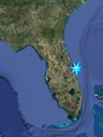
Upper St. John's River Marsh Wildlife
Management Area extends from
State Road 520 west of Cocoa and extends
down to encompass the headwaters of the
St John's River and Lake Blue Cyprus.
Consisting of more than 119,000 acres in
Brevard and Indian River counties, the
Wildlife Management Area is jointly
owned by the State and the St. John's
River Water Management District
(SJRWMD). The Florida Fish and Wildlife
Conservation Commission (FFWCC)
primarily manages and controls hunting
within the property while the Water
Management District controls habitat
restoration and recreational activities
during non-hunting times. For these
purposes the District has divided them
up into several different Conservation
Areas. The Northernmost is
River Lakes Conservation Area,
which begins just South of SR-520 West
of Cocoa and stretches south to SR-192
West of Melbourne, the entire coverage
area for this page. Of special interest
to boaters and kayakers are the
designated campsites and camping
platforms along the river north and
south of Lake Winder and along the
western shore of the lake itself. These
will be discussed farther on the
Backcountry Camping Pages.
Kayak and
canoe access points to the River Lakes
Conservation Area of the St John's River
are from James Bourbeau, Leroy Wright,
and Lake Washington parks covered
separately below.
FFWCC Brochure
River Lakes Property Map
Primative campsites and platforms.
|
|
|
F. Burton Smith Regional Park
7575 King Street (Hwy 520), Cocoa
FROM I-95 go 3 miles west on SR-520,
turn left into the park.
Open after 7:00 a.m. until dark, except
for scheduled use.
This expansive 1,080-acre scenic park
features two lakes, tributaries, and
rustic or primitive camping. No
motorized boats allowed.
ADA ACCESSIBLE: Parking, Restrooms,
Pavilions, Playground.
GPS N 28 21.968 W 80 51.475
Goggle Satellite Image |
|
|
|
James G. Bourbeau Memorial Park
8195 King St (Hwy 520), Cocoa
FROM the I-95 Exit-201, go west 5 miles
on SR-520. The park is located along the
St. Johns River next to Lone Cabbage
Fish Camp.
ADA ACCESSIBLE: Parking, Restrooms, Boat
Ramp, Dock, Pavilion.
GPS N 28 22.050 W 80 52.232
Goggle Satellite Image
|
|
|
|
Leroy Wright Recreation Area
8190 King Street (Hwy 520), Cocoa
FROM I-95 take the SR-520 Exit-201 west
4.9 miles. The park is on the right.
Situated along the flood plain of the
St. Johns River at the north side of
James G. Bourbeau Memorial Park, this
32.65-acre recreation area features a
paved ramp and paved parking for 21 cars
and 31 boat trailers. Picnic tables, 2
grills and benches offer added
convenience.
GPS N 28 22.290 W 80 52.273
Goggle Satellite Image
|
|
|
|
Lake Washington Park
6000 Lake Washington Road, Melbourne
FROM I-95 take the SR-518/Eau Gallie
Blvd Exit 183 east 0.4 miles. Turn left
on John Rhodes and go 0.8 miles. Turn
left on Aurora Blvd and stay straight
1.3 miles. Turn left on Lake Washington
Road and go 1.5 miles to the end of the
road.
FROM US Hwy 1 go west 5.6 miles to the
end of Lake Washington Road.
Boat ramps open 24 hours a day.
This shaded 25.96-acre community river
park is along the shore of Lake
Washington which accesses the St. Johns
River. The park has ramps for power
boats and a launch area for airboats.
Fishing is popular from the lake and the
120' fishing pier.
ADA ACCESSIBLE: Parking, Restrooms,
Pavilions.
GPS N 28 08.852 W 80 44.041
Goggle Satellite Image
|
|
|
|
|
|
|