|
|
|
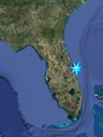
Boat Ramp Access
Space Coast Central, Indian River
Lagoon
|
|
(SR-528 Cocoa south to SR-192 Melbourne)
Note; Click on proerty name to go to
official website for property.
Note; This page is broken up into three
sections, Mainland, followed by Merritt
Island, followed by Beachside. Locations
are listed North to South in each
section.
|
|
Back to Indian River Lagoon Fishing
Locations
|
|
|
|
|
|
|
|
|
|
McFarland Park;
2060 Indian River Drive, Cocoa
FROM US Hwy 1 at SR-520, go north 2.6
miles on US Hwy 1. Turn right on Coquina
Drive and go 0.3 miles, turn right on
Indian River Drive and go 0.1 miles to
the park. One lane ramp for small boats
Open after 7:00 a.m. until dark.
Fishmap
GPS N 28 23.455 W 80 44.503
Google Satellite Image
|
|
|
Lee Wenner Park
300 Riveredge Boulevard, Cocoa
FROM US Hwy 1 at SR-520, go east .5
miles and turn right onto Riveredge
Drive. The park is on the Indian River
at the southwest side of the Hubert
Humphrey bridge.
Fishing Pier, Docks, Boat Ramps.
ADA ACCESSIBLE: Parking, Restrooms,
Coast Guard Auxiliary Building,
Pavilion, Playground, Paved Walkway,
Fishing Pier, Docks, Boat Ramps.
Fishmap
GPS N 28 21.321 W 80 43.382
Google Satellite Image |
|
|
|
POW/MIA Park,
Formerly known as Pineda Landing
5995 N US Highway 1, Melbourne
Parks Referendum Project
FROM the Pineda Causeway (SR-404), go
0.3 miles north on US Hwy 1, the park is
on the right.
Shoreline fishing, non-motorized boat
launch area, boat ramps.
Fishmap
GPS N 28 12.408 W 80 39.679
Google Satellite Image
|
|
|
|
|
|
|
|
|
Kelly Park-East
2550 N Banana River Drive, Merritt
Island
Parks Referendum Project
FROM US Hwy 1 go 5.3 miles east on
SR-528 then right at the N. Banana Drive
exit. The park is along the river on the
left. Boat ramp or sandy beach for kayak
launching,
Open after 7:00 a.m. until dark, except
for scheduled use.
Fishmap
GPS N 28 24.195 W 80 39.744
Google Satellite Image |
|
|
Kiwanis Island Park
951 Kiwanis Island Park Road, Merritt
Island
FROM US Hwy 1, go east 3.2 miles on
SR-520. Turn into the park complex at
the light just east of Sykes Creek
Parkway.
Shoreline and dock fishing, natural
launch area provide access for rowers
and paddlers into Sykes Creek. Boat Ramp
on site.
ADA ACCESSIBLE: Parking, Restrooms,
Community Center, Community Building,
Playground, Pavilions, Fishing Dock,
Paved Walkways
Park open after 7:00 a.m. until 9:00
p.m.
Fishmap
GPS N 28 21.540 W 80 40.689
Google Satellite Image |
|
|
|
|
|
|
|
|
Constitution Bicentenial Park;
Located on the State Road 520 Causeway,
just west of Cape Canaveral Hospital
Constitution Bicentennial Park is a
one-acre roadside recreation site
providing boat launch facilities. The
park was dedicated in 1988 as a
permanent reminder of the importance of
the U. S. Constitution. The park
features boat ramps, 23 car/trailer
parking spaces, and four sheltered
picnic tables.
Fishmap
GPS N 28 21.442 W 80 37.713
Google Satellite Image |
|
|
Ramp Road Park / Thousand Islands Cocoa
Beach
From State Road 520 in Cocoa Beach, head
south on A1A about 3 miles and turn
right on South 5th Street, then take the
next left on South Brevard Ave, then the
next left on Ramp Road. Located at the
west end of Ramp Road in Cocoa Beach,
this three-acre neighborhood park
provides two boat ramps, picnic
facilities, a fishing dock, and a
lighted tennis court. Florida Sportsman
magazine has ranked the park as one of
the state's best fishing spots. The
fishing dock and picnic facilities
overlook the beautiful Thousand Islands,
which are owned by the city. The city
plans to keep the Thousand Islands in
their natural state for future
generations to enjoy. With numerous
channels and mangrove shorelines, the
Thousand Islands are a great fishing
spot for reds, seatrout, and many other
species.
Fishmap
GPS N 28 18.558 W 80 36.855
Google Satellite Image |
|
|
Eau Gallie Causeway Boat Ramp;
Eau Gallie Causeway (SR-518),
Melbourne
ACCESS FROM the eastbound lane on the
east side of the causeway, or FROM
westbound lane through curb-cut in
median.
Park features a 4 lane boat ramp, 180 ft
fishing catwalk, natural windsurfing and
canoeing launch area.
ADA ACCESSIBLE: Docks
Fishmap
GPS N 28 08.157 W 80 36.367
Google Satellite Image |
|
Back to Top |
|
|