|
|
|
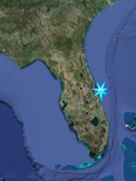
Boat Ramp Access
Space Coast North, Indian River
Lagoon
|
|
(Mosquito Lagoon south to SR-528
Cocoa)
|
|
Back to Indian River Lagoon Fishing
Locations
|
|
|
|
Scottsmoor Landing;
2400 Huntington Avenue, Scottsmoor
FROM US Hwy 1 at Garden Street (SR-406),
go 11.3 miles north on US Hwy 1, turn
right on Huntington Avenue and go 1.9
miles. This is the northernmost boat
ramp on the Main body of the Indian
River Lagoon. This part of the lagoon
offers some of the best chances to hook
into reds or trout in our area. Most of
your better fishing will be found on the
grass flats along the eastern shoreline
and northern basin where Turnbul Creek
enters the lagoon.
ADA ACCESSIBLE: Parking
Fishmap
GPS N 28 46.253 W 80 50.701
Google Satellite Image
|
|
|
Mims Launch Ramp;
2010 Jones Avenue, Mims
FROM US Hwy 1 at Garden Street (SR-406),
go 4.9 miles north on US Hwy 1, turn
right and go 1.2 miles on Wiley Avenue,
then go left on Hammock Road 0.2 miles,
turn right and 0.1 miles on Jones
Avenue.
Fishmap
GPS N 28 40.688 W 80 49.591
Google Satellite Image |
|
|
Marina Park;
501 Marina Road, Titusville
Parks Referendum Project
FROM US Hwy 1 and Garden Street, go
north on US Hwy 1 and turn right at
Marina Road. The park is just past
Titusville Marina.
Head North past Vectorworks for good
flats fishing.
Fishmap
GPS N 28 37.333 W 80 48.582
Google Satellite Image; |
|
|
Parrish Park-Titusville;
1 A. Max Brewer Memorial Parkway,
Titusville
SITUATED on both sides of SR-402 at the
A. Max Brewer Causeway from the east end
of the draw bridge to the security gates
for Kennedy Space Center.
Kayaks and Canoes can be launched from
either the boat ramp area or from either
side of the causeway east of the Marine
Patrol Station.
ADA ACCESSIBLE: Parking, Boat Trailer
Parking, Restrooms in Developed Area,
Fishing Deck, Boat Ramps.
Fishmap
GPS N 28 37.452 W 80 47.681
Google Satellite Image |
|
|
Merritt Island National Wildlife Refuge
and Canaveral National seashore;
(Note; Click Link for Refuge and
Seashore info.)
There are a total of six boat ramp areas
within Merritt Island National Wildlife
Refuge and Canaveral National Seashore.
Five of them are on the Mosquito Lagoon
and the sixth is at Blairs Cove off of
Haulover Canal, providing easy access to
both the Mosquito Lagoon and the Indian
River Lagoon. All except the Canaveral
Seashore North District boat ramp are
easitly accessed from the Titusville
Entrance to the refuge. A Boat Ramp map
can be found at the above link a little
below the Fishing Map, along with
Mapquest satellite imagary and GPS
numbers.
GPS N 28 37.929 W 80 47.031
|
|
|
|
Kennedy Point Park;
4915 S Washington Avenue, Titusville
On US Hwy 1 just .25 miles south of
SR-50 on the Indian River.
Boat ramps open 24 hours a day.
This 5.38-acre community river park
features a paved shoreline walkway with
benches for wildlife, shuttle viewing
and fishing; a boat ramp with central
dock; pavilion, 2 grills, restrooms, and
parking.
Fishmap
GPS N 28 33.211 W 80 47.755
Google Satellite Image
|
|
|
Port St. John Boat Ramp;
6650 N Cocoa Boulevard (US Hwy 1), Port
St John
Can be very crowded with trailer boat
launching!
FROM US Hwy 1 at Fay Blvd, the boat ramp
parking is along the Indian River just
south of the intersection.
FROM SR-520 go 8.8 miles north on US Hwy
1, turn right into the boat ramp parking
just south of the Fay Blvd intersection.
Fishmap
GPS N 28 28.506 W 80 46.048
Google Satellite Image |
|
|
|
|
|
|