|
|
|
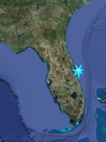
Boat Ramp Access
Space Coast South, Indian River
Lagoon
|
|
(SR-192 Melbourne south to Sebastain
Inlet)
Note; Click on proerty name to go to
official website for property.
Note; This page is broken up into two
sections, Mainland and Beachside.
Locations are listed North to South in
each section.
|
|
Back to Indian River Lagoon Fishing
Locations
|
|
|
|
|
|
|
Claude Edge Front St. Park
2210 Front Street, Melbourne.
Claude Edge Front St. Park is located on
Front Street along the Indian River in
Downtown Melbourne at the base of the
Melbourne Causeway. Features include
boat ramps, picnic areas, fishing pier,
pavillion, benches, shuffleboard.
GPS N 28 04.722 W 80 35.980
Google Satellite Image |
|
|
Pollak Park
1455 Main Street NE Palm Bay, FL 32905
This park features a boat ramp into
Turkey Creek near the mouth with the
Indian River Lagoon and a small
shoreline fishing area. From US-1 take
Palm Bay Road NE west and take the first
left after going over the railroad
tracks (Main St. NE). Follow Main St.
south to the end.
GPS N 28 01.934 W 80 34.967
Google Satellite Image |
|
|
A J Goode Park - Captain's House
1300 Bianca Drive NE Palm Bay, FL
32905
This park features a boat ramp and
fishing pier and is located on the south
shore of Turkey Creek. To get there from
US-1 in Palm Bay take Port Malabar Blvd
westward to Bianca Drive NE, turn right
and follow the road to the end. There
are some undeveloped islands in Turkey
Creek just off the parks boatramp.
GPS N 28 01.788 W 80 34.940
Google Satellite Image |
|
|
John Jorgensens Landing
5045 Highway 1, Grant
LOCATED on the Indian River Lagoon
2-miles south of Valkaria Road (0.3
miles north of First Street).
Boat ramps open 24 hours a day.
This active .49-acre boating area
includes 300' of shoreline and boat
ramps with docks and parking for 25 cars
and trailers.
ADA ACCESSIBLE: Parking, Dock
GPS N 27 56.250 W 80 31.791
Google Satellite Image |
|
|
First Street Boat Ramp
4727 1ST Street, Grant
FROM Valkaria Road, go 2.3 miles south
on US Hwy 1, turn left to the Indian
River.
Boat ramps open 24 hours a day.
This .54-acre boating area provides
access to the Indian River. Facilities
include a 1-lane boat ramp, parking for
30 cars and 6 trailers, and a boat dock.
ADA ACCESSIBLE: Parking, 160' Dock.
GPS N 27 55.750 W 80 31.561
Google Satellite Image |
|
|
|
|
|
|
|
|
Melbourne Causeway
Location: Extends along north and
south side of S.R. #192.
Indialantic.Size: 6,900 feet of river
frontage or 6.3 acres. Facilities:
Undeveloped off-road parking, access to
water.
GPS N 28 05.266 W 80 34.885
Google Satellite Image |
|
|
6th Avenue Boat Ramp and River Access
Pine St / 6th Ave Melbourne Beach,
FL 32951, From A1A and 5th Avenue (192)
in Indialantic, head South on A1A until
it runs into Ocean Avenue, proceed
straight forward, (the street becomes
Oak at Ocean Ave.) for six blocks to 6th
Avenue and turn to the west. The park is
at the end on 6th.
GPS N 28 03.755 W 80 33.830
Google Satellite Image |
|
|
Long Point Park
700 Long Point Road, Melbourne Beach
FROM US-192 (Melbourne Cswy) go 16 miles
south on SR-A1A and turn right into the
park.
FROM Sebastian Inlet go 1 mile north on
SR-A1A.
This 84.5-acre conservation area and
urban district river park offers
shoreline fishing, waterfront camping, a
fishing dock, a small bridge connecting
to Scout Island for additional fishing.
Also has nature trails and swimming
pool. Nice campground!
GPS N 27 52.475 W 80 28.213
Google Satellite Image |
|
|
Sebastain Inlet State Park
One of Florida's most popular state
parks, Sebastain is a mecca for snook
fishing and is easily located on Highway
A1A about 15 miles south of Melbourne
Beach. When you see the big bridge, you
are there. Shoreline fishing can be had
along the entire inlet shore, The north
and south jetties, surf fishing from the
beach south of the inlet, (the north
side is one of the most popular surfing
spots on the east coast of the country
so if your game is surf fishing, go to
the south side), two catwalks under the
bridge, a small dock at the campground,
(south side of the inlet) and the lagoon
to the west. Other species caught are
redfish, snapper, tarpon, seatrout, etc.
Great kayaking in the area but be
careful of the strong inlet currents.
Launch closer to or on the lagoon (west)
side. There are also hiking trails,
biking trails, good snorkeling, diving,
two museums, and a great sand bottom
shallow swimming and wading lagoon. A
boat ramp can be found on the south side
on the lagoon. There are two museums on
site. The McLarty Treasure Museum tells
the story about the Spanish Treasure
Fleet of 1715, that wrecked along the
florida southeast coast in that year.
The El Capitan was the northernmost
shipwreck of that fleet and sank on the
shallow sandbars within a mile of the
south jetty. The museum is on the site
of the survivors campground. The
Sebastian Fishing Museum tells the
history of the area's fishing industry.
GPS N 27 51.683 W 80 26.931
Google Satellite Image |
|
Back to Top |
|
|