|
|
|
Walking Trails and Greenways |
|
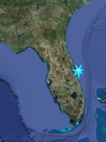
Space Coast Central |
|
Back to Hiking Home |
|
This section includes Walking Pathways
and Greenways for the Central Brevard
County Area. |
|
|
|
|
|
|
Dick Blake Park
From SR 520, go 4 miles south on US
Hwy 1, turn right on Gus Hipp Blvd and
go 0.4 miles. The park entrance is on
the right.
This 74-acre community park includes
active and passive recreation areas.
Visitors can walk or cycle from Murrell
Road into the park through scrublands
along a paved walkway that features a
wetland overlook. Park amenities include
a playground, pavilion, grills, a grassy
activity area, soccer/multiuse fields,
skateboard park, and a
restroom/concession building. A 30-acre
preserve is included in this park
GPS N 28 18.262 W 80 42.906
Google Satellite Image |
|
|
Riverwalk-A Family Park
5355 US Highway 1, Rockledge
FROM SR-520, go south 7 miles on US Hwy
1, look for the park on the left. You
will have to make a u-turn just to the
south of the park onto the northbound
lane. If coming from the south, it will
be about 4.5 miles north of the Pineda
Causeway.
Nature Center, and a nature boardwalk
that begins near the pavilion with
restrooms and winds through a natural
Florida hammock to the river. For
information about naure walks and other
activities, call 321-433-4490
GPS N 28 16.089 W 80 41.407
Google Satellite Image |
|
|
Wickham Park
2500 Parkway Drive, Melbourne
321-255-4307
Wickam Park is a popular 391 acre
park with semi-improved camping, about
four miles of narrow trails that meander
through oak hammocks, scrub, pine
flatwoods, and along marshy streams for
both equestrian and hiking use, a paved
walking trail, two unguarded swimming
ponds, and several more small ponds,
equestrian facilities, and a dog park.
Some of the species sighted here include
Brownheaded Nuthatch, Bobwhite, Painted
Bunting, Chuck-will’s-widow, Raptor,
Killdeer, Migratory Songbirds.
Park Map
GPS N 28 09.471 W 80 39.802
Google Satellite Image |
|
|
|
Erna Nixon Park
1200 Evans Road, Melbourne
Location
FROM US-192 by the Melbourne Square
Mall, go north on Evans Road 0.9 miles.
The entrance is on the left just before
Nasa Blvd.
Erna Nixon Park is a 53.93-acre natural
Florida hammock and nature preserve
located just south of Nasa Boulevard
southwest of the Melbourne Airport.
Although surrounded by a commercial
district, it is home to many birds and
small animals, including the protected
gopher tortoise and Indigo snake. A
popular site for nature walks and
outdoor festivals including the annual
Crackerfest, it features an elevated
boardwalk winding through three
different ecosystems where native plant
species and small animals can be viewed.
Habitats Florida Hammock, Pine
Flatwoods, Wetland
Watchable Wildlife Gopher
Tortoise, Indigo Snake; Listed in State
of Florida Great Florida Birding
Trail—Summer Tanager, Eastern Towhee,
and mixed Warbler flocks in migration
ADA Accessible Parking,
Restrooms, Pavilion, Nature Boardwalk
GPS
N 28 05.441
W 80 39.293
Google Satellite Image
|
|
|
|
|
|
|
|
|
Intracoastal Waterway Park
Hwy 520 Causeway at the Hubert Humphrey
Bridge, Merritt Island
FROM US Hwy 1 at SR-520, go east 0.7
miles just over the Humbert Humphrey
Bridge. Turn back to the SR-520
westbound lane. The park entrance is on
the westbound lane and the exit is on
the eastbound lane.
This 8.5-acre community river park is a
picturesque gateway to Merritt Island.
Landscaped with native trees and plants,
paved pathways and winding boardwalks
along the Indian River and features
small picnic shelters and a restroom on
the south side. The concrete fishing
pier features benches making it ideal
for viewing evening sunsets.
Open after 7:00 a.m. until dark.
GPS N 28 21.394 W 80 42.786
Google Satellite Image |
|
|
Rotary Park-Merritt Island
1899 S Courtenay Parkway, Merritt Island
Parks Referendum Project
FROM SR-520 go south 2.4 miles on S
Courtenay Parkway. The park entrance is
on the right.
FROM the Pineda Causeway (SR-404), go
north on South Tropical Trail/Courtenay
Parkway 8.9 miles. The park is on the
left.
This 37.77-acre community park includes
an interpretive nature boardwalk and a
1,500 sq. ft.Nature Center that
resembles a Florida Cracker style
schoolhouse and offers exhibits, tours
and classes that focus on the Florida
woods habitat. The Nature Center is the
result of the volunteer efforts of the
Merritt Island Rotary Club.To schedule a
tour or arrange a visit to the Nature
Center, call 321-455-1385.
Habitats found on the site include
Florida Hammock, Xeric Scrub and some
Wetlands which attract
hawk, osprey, migratory birds,
songbirds, Yellow-Throated Warbler,
Flicker, Red-bellied Woodpecker, Gopher
Tortoise, Snakes, Armadillo, Raccoon,
Opossum, Squirrel
ADA ACCESSIBLE: Parking, Nature Center,
Nature Boardwalk.
Open after 7:00 a.m. until dark, except
for scheduled use.
GPS N 28 19.583 W 80 41.114
Google Satellite Image
|
|
|
|
|
|
|
|
|
Lori Wilson Park;
1500 N Atlantic Avenue, Cocoa Beach
FROM SR-520 go south 1.4 miles on SR-A1A
Open after sunrise until dusk, except
for scheduled use.
This 32.43-acre regional beach park
featuring a maritime hammock is a
popular site for events and group
gatherings. The dunes and maritime
hammock allow visitors to experience
Florida’s natural coastline. The 3,155’
interpretive boardwalk at the Maritime
Hammock is accessed from the north
parking lot, or by paved walkway from
the south parking lot. Wildlife includes
migratory birds, Shorebirds, Songbirds,
Butterfly, Opossum, Raccoon, Snakes.
ADA ACCESSIBLE: Parking, Restrooms,
Pavilions, Playground, Boardwalk, 4 Dune
Crossovers, Nature Center, Nature
Boardwalk, Paved Walkways
GPS N 28 20.227 W 80 36.470
Google Satellite Image |
|
|
Hightower Beach Park;
815 Highway A1A, Satellite Beach, FL
32937, (321) 773-6458
Much to their credit, the coastal City
of Satellite Beach has taken great pride
in their natural resources, preserving
40 % of the beach front property within
the city in its natural state and
setting it aside for future generations
to enjoy. The flagship property of this
policy is Hightower Beach Park, roughly
18 acres of prisine beach and dune
habitat protecting roughly 1/2 mile of
coastline with an observation platform
and about 560 feet of boardwalk so
visitors can view the habitat and scan
the native vegetation for migratory
songbirds and other species that reside
there. In addition are the chances to
see examples of
Sabellarid Worm domes, which
are colonies of Sabellariid Worms
attached to the flatter coquina rock
ridges. At low tide the domes closest to
shore are exposed on the beach sometimes
forming tidal pools and are valuable
habitat for many species of marine fish,
shrimps, crabs, and many other
invertebrate species. Please do not
touch these domes as they are fragile
and essentially living ecosystems. Scan
the rocks at low tide for shorebirds and
wading birds hunting along the coquina
ridges, while several species of gulls
and terns can be seen scanning the water
below for baitfish. Below is more
information on Hightower Park and the
recent improvements which include
parking for 32 cars, restrooms, an
outdoor shower, and a non reservable
pavillion in addition to the boardwalk
and observation platform.
Here's an article on
Sabellariid Worm Reefs.
Sabellariid Worm Reefs
GPS N 28 11.650 W 80 35.661
Google Satellite Image |
|
|
|
|
|
|