|
|
|
Bird and Wildlife Watching
Freshwater and Uplands Habitats
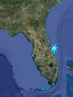
Space Coast South
|
|
|
|
Bird and
wildlife watching opportunities associated
with the St. Johns River, it's tributaries
and Upland Woods Habitats along Florida's
Space Coast. |
 This
Symbol indicates that the site is a
designated site of the
Great Florida Birding Trail This
Symbol indicates that the site is a
designated site of the
Great Florida Birding Trail
|
| |
|
Mainland
|
|
Turkey
Creek Sanctuary (Noteable Stop)
1518 Port Malabar Blvd. NE Palm Bay, FL
32905
Located behind the Community Center and next
to the Palm Bay Library at 1502 Port Malabar
Blvd. NE, Turkey Creek Sanctuary is over 100
acres of natural Florida along the banks of
Turkey Creek. There are jogging paths and a
boardwalk through the woods and overlooking
the creek with a canoe launch on site.
GPS N 28 01.016 W 80 36.289
Google Satellite Image
|
| |
Ais Trail Park (Noteable Stop)
2804 Hickory Ave. NE Palm Bay, FL 32905
The property is 17.7 acres with about 1000
feet of frontage on Turkey Creek. There is a
short boardwalk with a creek overlook and
trails into the uplands.
GPS N 28 01.932 W 80 35.261
Google Satellite Image |
| |
Palm Bay Regional Park (Quick
Stop)
1951 Malabar Road NW, Palm Bay
FROM I-95 Exit-173 take SR-514-Malabar
Road west 6 miles and turn right into
the park road.
Open after 7:00 a.m. until dark, except
for scheduled use.
Four lakes for fishing, viewing
wildlife, some pine flatwood forest on
property. Sightings include deer,
turkey, alligator, snake, duck, sandhill
crane, owl, migratory songbirds, and
others.
GPS N 28 00.455 W 80 43.987
Google Satellite Image
|
| |
|
Malabar
Scrub Sanctuary(Destination)
From I-95 take Exit-173 Malabar Rd
SR-514 and go east on Malabar Road about 3.1
miles. Turn left on Malabar Woods Boulevard.
Trailhead is located at the end of the road.
Kiosk and stabilized parking available.
From US Hwy 1 take Malabar Road west for 1
mile. Turn right on Malabar Woods Boulevard.
Trailhead is located at the end of the road.
Kiosk and stabilized parking available
This 395 acre sanctuary managed by the
Brevard County Environmentally Endangered
Lands Program boasts a variety of habitats
including xeric (dry) hammock, scrub,
scrubby flatwoods, pine flatwoods, sand pine
scrub, ponds, sloughs, and depression
marshes, and allow visitors to learn how the
habitats interact with each other and about
the crucial role that fire plays in health
of the ecosystem. This property has a
network of trails through the habitats and
the species on site include Florida scrub
jays, indigo snakes, gopher tortise, river
otter, great horned owl, pileated
woodpecker, sandhill crane, bobcat, and
migratory songbirds. An ADA trail runs
adjacient to the main entrance road to allow
access for the physically challenged.
Trails Map
GPS N 28 00.741 W 80 34.919
Google Satellite Image
|
| |
Jordan Scrub Sanctuary
(Destination)
End of Marie Street, Malabar.
From I-95 take SR-514 Exit-173 east onto
Malabar Road. Go 3.6 miles and turn right on
Marie Street (3 miles past the fire station)
and go 0.9 miles. When the paved road ends,
continue to the Sanctuary gate and kiosk.
Bike rack provided. Parking is not
available.
From US-1 go west on Malabar Road for 0.5
miles and turn left onto Marie Street for
0.9 miles. When the paved road ends,
continue to the Sanctuary gate and kiosk.
A variety of habitat types are found in this
354-acre sanctuary. including scenic lakes,
seasonal marshes, and scrubby flatwoods.
While hiking through the diverse habitats,
bald eagles can be spotted fishing for meals
in the lake, and local scrub-jays seen
foraging in the scrubby flatwoods.
Recreational planning for the Jordan Scrub
Sanctuary recently commenced-additional
trails are planned for future development.
GPS N 27 59.101 W 80 34.399
Google Satellite Image |
| |
Micco
Scrub Sanctuary (Destination)
North and south of Micco Road between
Babcock and I-95
500 Micco Road, Micco, FL 32976
From I-95 take the Malabar Road
Exit-(FL-514) east and turn right on Babcock
Street SE. Go south about 7 miles. Turn left
on Micco Road and go about .75 mile east.
Look for fenced, grassy parking area on the
left.
From US Hwy 1 go west on Micco Road 6.3
miles. Look for grassy parking area on the
right.
The Micco Scrub Sanctuary protects 1322
acres of Brevard’s remaining scrubby
flatwoods and mesic flatwoods habitat. This
mosaic of seasonal marshes and dry flatwoods
shelters many indigenous species of plants
and animals that cannot be found anywhere
else in the county. The long trails running
through the Micco Scrub Sanctuary give
hikers many chances to spot wildlife.
GPS N 27 52.461 W 80 36.860
Google Satellite Image |
| |
St.
Sebastian River Preserve State Park;
(Destination)
At 21,748 acres most of this property is
jointly owned with the State of Florida and
is located in Brevard and Indian River
Counties.
Access:
From I-95, take exit 73 and go east on
Malabar Road (State Road 514). Turn south
onto Babcock Road (County Road 507), travel
11.5 miles and turn east onto Buffer
Preserve Drive. The south entrance is off
Fellsmere Road (CR 512), 1.8 miles east of
I-95.
This site preserves open grassy forests of
longleaf pine that were once commonplace
throughout Florida. The pine flatwoods form
a backdrop for other biological communities,
including cypress domes, scrubby flatwoods,
sandhills, and a beautiful strand swamp.
These habitats are home to many native
plants and animals, including over 50
protected species. Photographers,
bird-watchers, and nature enthusiasts can
explore miles of trails on foot, bicycle, or
horseback. Also in the preserve where the
C-54 Canal meets with the St. Sebastain
River, West Indian manatees can be see
congregating. The preserve is divided into
four sections with the north and south
sections divided by the C-54 Canal and east
and west bisected by I-95. They are known as
the Northwest Preserve, Northeast Preserve,
Southeast Preserve, and the Southwest
Preserve. The Northeast Preserve is home to
the Green Trail loop (9.0 miles) but has no
designated campsites. The Northeast Preserve
is home to the Yellow Trail (9.7 miles and
has two camps, the Storytelling Camp and the
Pine Camp. The Southeast Preserve is home to
the Blue Trail (10 miles) and has 3 camps,
the Deer Camp, the Tree Frog Camp, and the
Mullet Camp. The Southwest Preserve is home
to the Red Trail (14 miles) and has one
camp, the Eagle Camp.
For information about the Visitors Center or
Camping, please call 321.953.5004.
State Parks Map
SJRWMD Website
Property Map
GPS N 27 49.479 W 80 36.401
Google Satellite Image |
| |
|
The
Upper St. John's River Marsh Wildlife
Management Area extends from State
Road 520 west of Cocoa and extends down to
encompass the headwaters of the St. John's
River and Lake Blue Cyprus. Consisting of
more than 119,000 acres in Brevard and
Indian River counties, the Wildlife
Management Area is jointly owned by the
State and the St. John's River Water
Management District (SJRWMD). The Florida
Fish and Wildlife Conservation Commission
(FFWCC) primarily manages and controls
hunting within the property while the Water
Management District controls habitat
restoration and recreational activities
during non-hunting times. For these purposes
the District has divided them up into
several different Conservation Areas, Three
Forks, Blue Cypress and Fort Drum. The
access points will be discussed for each
individual conservatoion area starting just
below. Of special interest to boaters and
kayakers are the 7 designated campsites
and camping platforms within the Three
Forks Area. These will be discussed farther
on the Backcountry Camping Pages.
FFWCC Brochure
Primitive campsites and platforms
|
| |
|
Three Forks Marsh Conservation Area
(Destination)
There are two primary trailheads for birding
the three forks conservation area. The
northermost trail head is the Thomas O
Lawton Recreation Area and can be accessed
from the Malabar Road exit from I-95 and
following Malabar Road to it's west end.
Gates open at sunrise and close at sunset.
The southern trailhead is at the Fellsmere
Grade Recration Pad at the Sick Marsh / Farm
13 area. and can be accessed from I-95 by
taking the east exit for Malabar to Babcock
Street, turn south on Babcock until you
cross the C-54 Canal, turn west on the
Fellsmere Grade Road and follow this to the
end.
Three Forks Conservation Area is about
52,000 acres in size and it is within this
area that the first actual discernable
channels of the St. Johns River take shape
in the form of three forks that come
together to form the actual river. The
birdwatching here is done from hiking and
biking trails built upon the levees
constructed by the St. John's River Water
Management District in order to improve
water quality of the headwaters and restore
the river to its natural state after years
of draining the wetlands for agricultural
use. The water management impoundments
provide great opportunities for seeing
waterfowl, wading birds, raptors, deer,
alligators, river otters, and many other
species. The dike trail between the two
trailheads is about 16.9 miles in length.
There is a shelter about halfway between the
trailheads, and an observation tower about
2.5 mile north of the fellsmere grade
trailhead overlooking the T.M Goodwin
Waterfowl Management Area. Note; The
Fellsmere Grade Trailhead also serves as the
northernmost trailhead for the Blue Cypress
Conservation Area listed just below.
Out in the Boonies Website
Property Map
Thomas O Lawton Trailhead
GPS N 27 59.002 W 80 45.277
Google Satellite Image
Fellsmere Grade Trailhead
GPS N 27 49.343 W 80 42.478
Google Satellite Image
|
| |
Blue
Cypress Conservation Area
(Destination)
Property map
Location:
This conservation area is 54,458 acres in
size and extends from the Fellsmere Grade
along C-54 Canal at the top of the Stick
Marsh southward to State Road 60 west of
Vero Beach in Indian River County. The area
contains virtually all of the wetlands that
eventually feed the St. Johns River. Like
the Three Forks Conservation Area the
birdwatching here is done from hiking and
biking trails built upon the levees
constructed by the St. John's River Water
Management District in order to improve
water quality of the headwaters and restore
the river to its natural state after years
of draining the wetlands for agricultural
use. The water management impoundments
provide great opportunities for seeing
waterfowl, wading birds, raptors, deer,
alligators, river otters, and many other
species.
Fellsmere Grade Trailhead /
Stick Marsh
GPS N 27 49.343 W 80 42.478
Google Satellite Image
The northern trailhead for Blue Cypress
is at the Fellsmere Grade Recration Pad at
the Sick Marsh / Farm 13 area. and can be
accessed from I-95 by taking the east exit
for Malabar to Babcock Street, turn south on
Babcock until you cross the C-54 Canal, turn
west on the Fellsmere Grade Road and follow
this to the end. While heading north from
the recreation pad / trailhead on the levee
take you to Three forks Conservation Area,
heading south on Levee 75 (L-75) from this
point takes you along the eastern edge of
the Stick Marsh.
The Stick Marsh is an impoundment
designed to contain and treat water from the
C-54 Canal, prevent flooding, and reduce
freshwater inflow into the Indian River
Lagoon to the east. The name Stick Marsh
refers to the standing dead trees in the
water from when the area was impounded and
flooded. However, many of these standing
dead trees were blown down by Hurricane
Wilma in 2005. By continuing past the
stick marsh on L-75, you will eventually
come to a turn to the east and shortly come
to a levee intersection with L-77,
which takes you to an additional trailhead
on State Road 60. If you stay on L-77
east, you are now walking along the northern
edge of the Blue Cypress Restoration Area.
After about 1.5 miles, L-77 turns to the
south and passes a trailhead / boat launch
and parking area for access to the Blue
Cypress Restoration Area.
Blue Cypress Restoration Area
GPS N 27 39.762 W 80 38.667
Google Satellite Image
Paddling Map
From the State Road 60 exit if I-95 in
Vero Beach, head west on SR-60 for 7.7
miles, and turn right on County Road 512.
Follow this for 1.5 miles, and the Blue
Cypress Recreation Area will be on your
left. The north south levee here is L-75
while the one heading due west is called the
Farm Levee and does not extend across the
impoundment to Levee 77, which forms the
western border of the impoundment. The levee
numbers are shown on the Property Map
(Linked just above)
Blue Cypress Restoration area is an
impoundment adjacent to the Blue Cypress
Conservation Area designed to improve the
water quality of the Upper St. Johns River
and is a deepwater cypress wetland where a
paddling and small boat series of loop
trails has been marked by red and white
buoys, depending on which trail you are on.
From the parking lot of the Blue Cypress
Recreation Area on CR 512, you may walk in
several directions. One of the westbound
dikes will offer more remote, sometimes
higher quality birding. However these paths
are narrower with irregular surfaces. A
north-south dike offers a smoother walking
surface, although the path is more exposed
and birds are harder to spot. It
should be noted however that the dikes
heading east from the parking area are
Private Property and tresspassing is not
allowed. This area contains foraging and
nesting habitat for the endangered snail
kite and many other species can be seen here
as well including all of the egrets and
herons (including both night-herons), glossy
and white ibises, purple gallinules,
limpkins and wood storks. Wood ducks and
Florida mottled ducks are found year-round,
and the marshes are used extensively in fall
and winter by migratory waterfowl and
shorebirds. Bald eagles, hawks, vultures,
anhingas, ospreys and crested caracaras are
commonly seen. American and least bitterns,
king rails, soras and fulvous
whistling-ducks may be viewed here as well
as river otters and alligators.
State Road 60 Trailhead
GPS N 27 38.478 W 80 40.730
Google Satellite Image |
| |
Fort Drum Marsh Conservation Area(Destination)
This area contains a mosaic of wetland
and upland communities. The marsh area
represents the southernmost reach of the St.
Johns River’s headwaters. The area was
acquired as part of the Upper St. Johns
River Basin Project, undertaken jointly by
the District and the U.S. Army Corps of
Engineers. The diversity of plant
communities has been shaped by both people
and nature. Natural communities include dry
prairie, pine flatwoods, hardwood swamp and
freshwater marsh. The diverse habitats
support Florida sandhill cranes, wood
storks, caracara, bald eagles, deer, turkey
and a large population of feral hogs.
Property Map
Trail Map
GPS N 27 38.444 W 80 46.016
Google Satellite Image |
|
|
|
|