|
|
|
Bird
and Wildlife Watching |
|
Indian River Lagoon and Seashore |
|
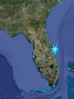
Space Coast North
|
|
|
|
Bird and
wildlife watching opportunities associated
with the Indian River Lagoon and Beaches
along Florida's Space Coast. |
 This
Symbol indicates that the site is a
designated site of the
Great Florida Birding Trail This
Symbol indicates that the site is a
designated site of the
Great Florida Birding Trail |
|
|
|
Jump Menu
Canaveral
National Seashore |||
Merritt Island National Wildlife Refuge
North
Merritt Island|||
Mainland
|
| |
|
Lighthouse
Point Park; Ocean
5000 S. Atlantic Ave. Ponce Inlet (386)
756-7488
Directions; From Daytona Beach, take I-95
south toward Miami. Take SR-421, Exit 256,
toward Port Orange. Take the Taylor Road
ramp toward Port Orange/Daytona Beach
Shores. Merge onto FL-421 East. FL-421 east
becomes FL-A1A North/Dunlawton Avenue. Turn
right on South Atlantic Avenue (4075) and
drive straight to the park.
Lighthouse Point Park consists of 52 acres
of pristine land on the north side of Ponce
DeLeon Inlet in the Town of Ponce Inlet. The
52-acre park features fishing, nature
trails, an observation deck and tower,
swimming and picnicking.
A variety of wildlife call the Lighthouse
Point Park home, including raccoons,
possums, skunks, armadillos, shore birds and
birds of prey.
Park GPS N 29 04.707 W 80 55.394
Park Google Satellite Image
Just to the North of the Park is the
Ponce Inlet Lighthouse and Museum,Florida's
tallest lighthouse where visitors can climb
203 steps to the top of the 175 foot tower
and enjoy magnificent views of the World's
Most Famous Beach, Ponce Inlet, and
surrounding inland waterways from the
lighthouse gallery deck
Lighthouse GPS N 29 04.840 W 80 55.681
Lighthouse Google Satellite Image
|
| |
|
Symrna
Dunes Park;
Ocean and Lagoon
Directions;
From the west: Take the North or South
Causeway east. Proceed north on Peninsula
Drive for two to three miles.
From the south: Take S.R. A1A north to
Flagler Avenue and turn left. Turn right on
Peninsula Avenue and go north two miles.
The park consists of five ecosystems (ocean,
river, dunes, scrub zone, saltwater marsh).
The principal system is vast sand dunes. To
protect the sensitive sand dunes from foot
traffic, two miles of elevated walkways,
picnic areas, pavilions and an observation
tower were built, allowing visitors to
travel through the park in a natural
environment. On the estuary side look for
assorted shorebirds, especially during lower
tidal phases while gulls terns and gannets
can be seen diving for baitfish
GPS N 29 03.962 W 80 54.889
Google Satellite Image
|
| |
Canaveral National Seashore
|
|
Jump Menu
Beachside |||
Merritt Island National Wildlife Refuge
North
Merritt Island|||
Mainland
Back to
Top
|
| |
|
Canaveral
National Seashore;
There are two
distinct districts with two separate
entrances and you cannot drive between the
two. The North or Apollo District is
accessed from New Symrna Beach in Volusia
County while the South or Playalinda
District is accessed from Titusville.
Owned by NASA, this property is managed
by the National Park Service and protects
roughly 26 miles of Atlantic Ocean Shoreline
and provides nesting grounds for up to 7
species of sea turtles while protecting
natural dunes, coastal strand scrub, salt
marsh and other wetlands, and virtually the
entire body of the Mosquito Lagoon. Over 300
species of birds have been seen at the
seashore from gulls, pelicans, ducks,
herons, egrets, terns, gannets, assorted
shorebirds, and raptors, to painted
buntings, migratory songbirds in the hammock
areas and scrubjays just inside the north
district entrance.
Map of Merritt Island National Wildlife
Refuge and Canaveral National Seashore
|
| |
|
Canaveral North District
|
| |
|
Beach
Access Points;
The North
District is accessed through the city of New
Symrna Beach in Volusia County by driving
due south on Highway A1A from town. There
are five Beach Access Points along the
Apollo Beach (North District) section of
Canaveral, with the first of these is right
at the entrance or pay station of the
Seashore, and the last about 6.4 miles south
on Atlantic Ave. Each of these provide
opportunities for seeing gulls, terns,
gannets, and various shorebirds while the
scrub on the dunes can hold gopher tortoises
and various migratory bird species. The
beaches also provide another opportunity,
although rare. Each winter, Northern
Right Whales migrate south from their
feeding grounds off of the Northeastern
United States to the area from the Georgia
Border to Sebastian Inlet in South Brevard
County to mate and calve. The occasional
sighting of a mother and her calve just a
few hundred yards offshore can be a
spectacular site. Also look for Atlantic
Bottlenose Dolphins and the occasional
jumping Manta Ray.
GPS N 28 56.211 W 80 49.817
Google Satellite Image
|
| |
Turtle
Mound
Turtle Mound Trail leads to the Turtle
Mound, so named because it loosely resembles
a turtle. The Turtle Mound is a Timcuan
Indian midden, not to be confused with an
Indian Burial Mound. A midden is essentially
a garbage pile made over many years as the
Timicuan discarded the shells of oysters,
clams and other shellfish that they depended
on heavily for food. Other artifacts were
tossed in as well. Today this mound is
roughly 35 feet in height and is a protected
treasure trove of insight into the lives of
the Timicuan before the arrival of
Europeans. The trail is roughly 1/3 of a
mile in length.
GPS
N 28 55.829 W 80 49.542
Google Satellite Image |
| |
|
Eldora
Statehouse Trail
This short trail can be accessed from
parking area #8 and leads to the Eldora
State House, after passing through a coastal
hammock. Built during the 1800s the house
was one of several large houses built in the
community of Eldora after the Civil War and
later served as a hotel for passengers
traveling by steamboat along the Mosquito
Lagoon.
Here's a quick history of the area from the
Library of Congress Website
GPS N 28 54.565 W 80 49.111
Google Satellite Image
|
| |
Eldora
Hammock Trail
Eldora Hammock is a one mile loop taking
visitors through a coastal hammock, good
opportunities for seeing migrant songbirds
and learning about this habitat through
interpretive signage.
GPS N 28 54.519 W 80 48.920
Google Satellite Image |
| |
Castle
Windy
This is a one way trail about a half mile in
length that provides a unique birding and
ecotouring opportunity, by allowing you to
travel from the Atlantic Shoreline to the
Mosquito Lagoon, noting the changes in
vegetation, geology or topography and the
wildlife. On the lagoon end of the trail is
Castle Windy Midden, a Timucaun Indian shell
midden.
GPS N 28 53.903 W 80 48.215
Google Satellite Image |
| |
|
Canaveral South
District
|
| |
|
Beach
Access Points;
The South District can be found by
driving across the Max Brewer Causeway from
Titusville through the Merritt Island
National Wildlife Refuge, staying to the
right when you see the sign for Black Point
Wildlife Drive. You are now on SR 402. Stay
on this road past the red light at SR 3,
through the pay station until the road turns
to the north at the beach and you see the
numbered beach access points.
There are 13 Beach Access Points along the
Playalinda Beach (South District) section of
Canaveral. After the pay station. Each of
these provide opportunities for seeing
gulls, terns, gannets, and various
shorebirds while the scrub on the dunes can
hold gopher tortoises and various migratory
bird species. The beaches also provide
another opportunity, although rare. Each
winter, Northern Right Whales migrate
south from their feeding grounds off of the
Northeastern United States to the area from
the Georgia Border to Sebastian Inlet in
South Brevard County to mate and calve. The
occasional sighting of a mother and her
calve just a few hundred yards offshore can
be a spectacular site. Also look for
Atlantic Bottlenose Dolphins and the
occasional jumping Manta Ray.
GPS N 28 39.108 W 80 37.793
Google Satellite Image
|
| |
The
Vistas
The Vistas of the Southern District of
Canaveral National Seashore are between the
Pay Station and the Beach Access Road as it
passes through the southernmost wetlands and
impoundments of the Mosquito Lagoon. They
offer places to pull off of the entrance
road and scope or take in the great views of
the impoundments, wading birds, waterfowl,
or many other species, as well as the Space
Shuttle Launch Pads. In fact, this is as
close as you can get to a launch pad without
either working at the Kennedy Space Center,
taking the Kennedy Space Center Visitor
Center Bus Tour or having a NASA Pass.
(Note, the refuge and seashore are closed
for launches) There are 7 of these sites
past the pay station and are the only places
where it is allowable to stop your car
except in case of emergencies. (Birdwatching
is not an emergency). many of these offer
spectacular vantage points of expansive
saltmarsh wetlands. Satellite image of
Vistas shows Vistas 2 - 4 with #3 marked.
GPS (Entrance) N 28 38.696 W 80
40.999
Google Satellite Image (Entrance)
Google Satellite Image (Vistas) |
| |
|
Eddy
Creek
Eddy Creek is located between beach
parking lots 7 and 8 and provides to only
access to the Mosquito Lagoon within the
southern district of the Seashore. From the
shoreline you can spot for pelicans,
waterfowl and wading birds in the cove while
also scanning the trees surronding the cove
for neotropicals.
GPS N 28 40.541 W 80 38.884
Google Satellite Image
|
| |
Merritt
Island National Wildlife Refuge
|
|
Jump Menu
Beachside ||| Canaveral
National Seashore
North
Merritt Island|||
Mainland
Back to
Top
|
| |
|
Merritt
Island National Wildlife Refuge;
Owned by NASA and home of Kennedy Space
Center, the Merritt Island National Wildlife
Refuge has been managed by the US Fish and
Wildlife Service since 1963. Though there
are four entrances open to NASA workers,
only two are available to provide access to
the public portions of the refuge, and they
are the Max Brewer Causeway in Titusville
and the State Road 3 entrance from US 1 just
south of the town of Oak Hill in Volusia
County. This is a large refuge, 140,000
acres and there are many locations scattered
throughout the refuge that provide access to
some of the best bird and wildlife watching
to be found anywhere. In order to provide
the most complete guide, each site will be
handled separately as individual
destinations, starting with Wildlife
Drives, then Hiking Trails, and
finally Drive to Vantage Points.
GPS Oak Hill Entrance N 28
50.049 W 80 50.512
Google Satellite Image, Oak Hill Entrance
GPS Titusville Entrance N 28 37.698 W 80
47.288
Google Satellite Image, Titusville
Entrance
Merritt Island National Wildlife Refuge
Map
North Brevard Business Directory Refuge
Website
|
| |
|
MINWR Wildlife
Drives
|
| |
There is only one
designated wildlife drive on the refuge, but
it is dedicated for wildlife observation
only and that is Black Point Wildlife
Drive, where no fishing is allowed
however, there are many other dike
impoundment roads available for bird and
wildlife watching from the car, although you
may be sharing the road with fishermen, and
they may be closed off to all but Duck
Hunters during hunting periods.
Photography hint; Many birds that
would otherwise be frightened by a human
figure are not frightened by a motor
vehicle. These roads give photographers with
lenses in the 150-300 mm ranges their best
chances for impressive bird portraits. Use a
small pillow or a bean bag on a window
raised or lowered to the correct height to
steady the camera. Turn the motor off to
eliminate vibration from the engine and
shoot from the car. There are also specialty
camera supports for photography from a
vehicle. The point is to use the vehicle as
a mobile photo blind and avoid the
temptation to get out of the car as this
will likely spook the birds. |
| |
|
Black
Point Wildlife Drive;
The best place to see wildlife is along
the Black Point Wildlife Drive. The 7-mile,
one-way drive follows a dike road around
several shallow marsh impoundments and
through pine flatwoods. This provides an
excellent place to see waterfowl (in
season), wading birds, shorebirds and
raptors. Alligators, river otters, bobcats,
various species of snakes, and other
wildlife may be visible as well. A
self-guiding brochure (available near the
drive entrance) will provide information on
things to look for. One to two hours after
sunrise and one to two hours before sunset
are typically the best times to view
wildlife actively feeding in the
impoundments. Driving time is approximately
40 minutes
GPS N 28 39.538 W 80 45.311
Google Satellite Image
|
| |
|
The Creek Roads
|
| |
West
Gator Creek Road
West Gator Creek Road can be accessed at two
locations from State Road 406 from
Titusville. The first is at the entrance
kiosk parking lot. The entrance to the road
will be at the far west of the parking area.
from here the road will go along the western
edge of the lagoon to the mouth of Gator
Creek then turn to the northeast along the
creek. The second entrance is the next left
from State Road 406 less than a mile from
the refuge entry kiosk. This entrance is
actually just referred to as Gator Creek
Road and splits into East and West Gator
Creek Roads a few hundred yards from this
entrance. Look for wading birds in the
impoundments within the dike and neotropical
migrants along the roadside trees and
bushes. Close to the eastern entrance
Catfish Creek Road
GPS West Entrance N 28 37.666 W 80
47.229
Google Satellite Image West Entrance
GPS East Entrance N 28 38.195 W 80
46.639
Google Satellite Image East Entrance |
| |
|
East
Gator Creek Road
East Gator Creek can be accessed from two
locations. The first is a shared entry with
West Gator Creek on the right less than a
mile from the Refuge Entrance Kiosk while
the second is west on SR 406 until after it
veers to the right at the turnoff for Black
Point. (Where it becomes SR 402). Just after
this point you will see the second entrance
on the right.
GPS West Entrance N 28 38.195 W 80
46.639
Google Satellite Image West Entrance
GPS East Entrance N 28 38.575 W 80
45.988
Google Satellite Image East Entrance
|
| |
Catfish
Creek Road
Catfish Creek is accessed from East Gator
Creek Road, which is accessed from the
shared entrance of Both Gator Creek Roads.
Take state Road 406 a bit less than a mile
into the refuge from Titusville and turn
right onto Gator Creek Road, then take the
first left intersection you come to, this is
east Gator Creek Road. Follow the road
around the shoreline until you come to a
right intersection. Take this and you are on
Catfish Creek Road, which leads to and loops
around a salt marsh impoundment. When you
come to a three way intersection, a left
turn will take you to the northwestern
shoreline of catfish creek, you will pass
one more side path on your left which is
Peacocks Pocket Road. Stay on Catfish Creek
road and you will travel to the Indian River
lagoon Shoreline, follow the shoreline
around to the South East Shore of Gator
Creek and back to the three way intersection
marked by the Green Arrow on the Google
satellite Image.
GPS N 28 37.941 W 80 46.305
Google Satellite Image |
| |
|
Peacocks
Pocket Road
Peacocks Pocket is accessed from State
Road 406. A little less than 1 mile into the
refuge, turn right on Gator Creek Road. Take
the first left on East Gator Creek, then
take the first right on Catfish Creek Loop
Road, then take the next left at the three
way intersection follow the shoreline and
take the next left. This is Peacocks Pocket
Road which lead to the shoreline of the
Indian River Lagoon and follow it all the
way to Peacocks Pocket, one of several coves
in the area. When the lagoon shoreline
section of the road ends it will turn left
be a straight shot for a little over 2 miles
through wetlands and pine forest back to
State Road 402 near the Refuge
Headquarters.To head back to Titusville,
turn left.
GPS N 28 37.549 W 80 46.418
Google Satellite Image
|
| |
|
Biolab
Road
Biolab Road is accessed by following
State Road 406 from Garden Street in
Titusville. After entering the refuge look
for the turnoff to Black Point Wildlife
Drive at the bend in the road. Turn off here
and follow the roadway past the entrance to
Black Point until it ends at State Road 3.
Turn to the north and look for NASA's
Atmosheric Sciences Laboratory about 1 and
1/2 miles on the right (east) side of the
road. Turn onto the dirt road and befor you
get to the boat ramp at the end you will see
a right turn. This is Biolab Road, which
will take you along the shorline of mosquito
lagoon to you're left and wetlands and salt
marsh on your right. Look for alligators
along the roadside canals, herons and egrets
in the wetlands and white pelicans in the
lagoon.
Editors Note; If you really want to
see an alligator, the canals that
follow this road that were built when the
dike road was built is THE best place to see
them. Along most of the dike roads including
Black Point you might see one, two, or maybe
three. In one trip along Biolab I counted
several dozen big ones.
GPS N 28 42.368 W 80 43.315
Google Satellite Image
|
| |
|
MINWR Hiking
Trails
|
| |
There are several
hiking trails on the refuge and they offer a
chance to experience a variety of habitats
and the birds and other wildlife species
associated with those habitats.
Photography hint; Let's say you're
hiking the Cruickshank Trail and there is a
heron near the shore by the trail, or just
across one of the channels that line the
trail in a mangrove tree. You want to get a
good shot with your camera but you are
worried about spooking the animal into
flight. If you try to stalk the animal you
will spook it. Why? Because you are acting
exactly like a predator. Being sneaky while
keeping your eyes on the animal will scare
the bejesus out of it. That's exactly what
bobcats and other predators do. Stay in full
view of the animal and don't stare. Act like
you don't care if it is there. Look around
on the ground, whistle softly, move
casually, no sudden moves, etc. |
| |
Visitor
Center Trail
To get to the refuge visitor's center,
stay on the main road as it veers to the
right (at which point it becomes State Road
402). You will soon see the entrance on the
right about 2.3 miles past the Black point
turnoff.
The Visitor's Center has interactive
displays and an information desk inside, and
outside has a dock leading over one
freshwater pond with an osprey's nest
visible on an elevated platform, To the
right, a boardwalk winds along the shoreline
habitat leading to a gazebo over another
pond. Red bellied and pileated woodpeckers
can be seen as well as northern parulas,
gray catbirds, carolina wrens, american
redstarts, and many other songbirds.
GPS N 28 38.602 W 80 44.202
Google Satellite Image |
| |
|
Oak
Hammock Trail / Palm Hammock Trail;
The Hammock Trails are found about a mile
east of the visitor's center on the left,
where parking is provided and two loop
trails take you through the hammocks and
wetlands. The Oak Hammock trail is about 3/4
mile in length while the Palm Hammock Trail
runs about 2 miles. Both of these trails can
be pretty wet following periods of rain and
be sure to bring plenty of bug repellent
from about March through October. Songbirds,
Peleated woodpeckers, and raptors can be
spotted along these trails along with some
wading birds. Other possible sightings
include bobcats, raccoons, and other
woodland wildlife.
GPS N 28 38.636 W 80 42.993
Google Satellite Image
|
| |
|
Wild
Birds Unlimited Trail
Bird trail is the first of two trails
accessed from Black Point Wildlife Drive.
The trailhead is about 1.7 miles into the
wildlife drive to your left. There is a
parking area just past the trailhead and the
trail is due south This short trail offers
an ADA accessable elevated viewing platform
overlooking a shallow marsh. Wading birds
and shorebirds often gather here in large
numbers. Spotting scope included on
platform.
GPS N 28 39.346 W 80 46.637
Google Satellite Image
|
| |
|
Cruickshank
Trail;
About halfway through Black Point Wildlife
Drive there is a parking area with restrooms
forming the trailhead for the Cruickshank
Trail, a walking trail that follows the
impoundment dike around the wetlands for
about 4 1/2 miles. Good place for egrets,
herons, ducks, pelicans, and numerous other
waterfowl. Just a few hundred feet to the
left of the trailhead is an elevated
platform with a mounted spotting scope for
viewing the vast salt marsh visible from
this elevation.
GPS N 28 40.708 W 80 46.338
Google Satellite Image
|
| |
|
Scrub
Ridge Trail
The Scrub Ridge Trail features the favored
habitat of the Florida Scrub Jay, an
endemnic species to the state, existing
nowhere else. It is a one mile loop through
a habitat of low lying scrub oak and
palmetto bushes. In addition to the Scrub
Jay, many migratory birds use the low scrub
for food and habitat while the skies are
often patrolled by Raptors. Indigo snakes,
gopher tortises, armadillos, and bobcats are
other possible sightings.
The trailhead can be found by taking the Max
Brewer Causeway across the river (SR 406)
and taking The Black Point turnoff to the
left then continuing on past the entrance to
Black Point Wildlife Drive until the road
ends at SR 3. Turn left (north) and you will
see the sign pointing the way down a dirt
road on your right (east) to the trailhead.
Most of the vegetation here is pretty low
(ie, not much shade) so I would recommend
bringing a hat, sunscreen, and water.
GPS N 28 41.700 W 80 42.949
Google Satellite Image
|
| |
|
Pine
Flatwoods Trail;
The Pine Flatwoods Trail is located
north of haulover Canal on the east side of
State Road 3 and is a one mile loop through
a pine flatwoods. The trailhead can be found
by taking the Max Brewer Causeway across the
river (SR 406) and taking The Black Point
turnoff to the left then continuing on past
the entrance to Black Point Wildlife Drive
until the road ends at SR 3. Turn left
(north) and drive for 7.2 miles. The
trailhead will be on the right (east).
GPS N 28 46.181 W 80 47.195
Google Satellite Image
|
| |
|
MINWR Drive to
Vantage Points
|
| |
|
Viewing
Tower at Cruickshank Hiking Trail;
Located a few hundred feet to the left
of the Cruickshank Trail Trailhead is an
elevated platform with a mounted spotting
scope for viewing birds within the vast salt
marsh visible from this elevation.
GPS N 28 40.708 W 80 46.338
Google Satellite Image
|
| |
|
Manatee
Viewing Deck, Haulover Canal;
From Titusville, take SR-406 to
sr-3 and head north until you cross over the
canal, then take the first right and follow
the road to the deck parking area.
From Oak Hill, just follow SR-3 south and
turn left just before the bridge.
Located on the Nartheast side of
Haulover Canal, the manatees seem to love to
hang out in large numbers near this deck. If
you really want to see a manatee, this is
the most likely place.
GPS N 28 44.263 W 80 45.285
Google Satellite Image
|
| |
|
Haulover
Canal;
The Haulover Canal area has several good
vantage points for setting up a spotting
scope and scoping for birds but the best is
probably the North side of the canal at the
Westernmost end. Here you can see Bird
Island, the rookery island to the west and
explore the cove adjacient to the canal.
Look for dolphins and manatees entering the
canal here as well as ospreys, waders,
pelicans, comorants, and many others.
From Titusville, take SR-406 to sr-3
and head north until you cross over the
canal, then take the first left and follow
the road to the canal, and turn right to the
end of the road. From Oak Hill, just follow
SR-3 south and turn right just before the
bridge, follow the road to the canal, and
turn right to the end of the road. You can
also stop at several of other spots along
the canal for viewing.
GPS N 28 43.847 W 80 45.667
Google Satellite Image
|
| |
Merritt Island
Locations outside of the Wildlife Refuge
|
|
Jump Menu
Beachside ||| Canaveral
National Seashore |||
Merritt Island National Wildlife Refuge
|||
Mainland
Back to
Top
|
| |
Pine
Island Conservation Area;
2121 Pine Island Road, Merritt Island
From SR-528 (Beeline Cswy) take SR-3 north
for 5.5 miles. Turn left on Pine Island Rd
and go 2.5 miles to the unpaved parking area
at the entrance.
From SR-520 go north on Courtenay Parkway
(SR-3) across the Barge Canal and continue
for 5.5 miles. Turn left on Pine Island Rd
and go 2.5 miles to the unpaved parking area
at the entrance.
Pine Island is not actually and island. The
name comes from the fact that an "island" of
pine flatwoods is surrounded by other
habitats, including on one edge the Indian
River Lagoon without the normal habitat
transition from pine flatwoods to wetlands
to lagoon. There are also mangrove forests,
hardwood hammocks, and cabbage Palm
Hammocks. The diversity of habitats for many
species of wading birds, shorebirds,
waterfowl, and migratory birds is a
prominent feature of the conservation area.
Reptiles and amphibians including alligators
and aquatic turtles are common, as are
mammals such as bobcats, river otters,
raccoons, and opossums that seek food and
refuge on the site.
Map
GPS N 28 29.507 W 80 43.302
Google Satellite Image |
| |
Kings Park
995 Chase Hammock Road, Merritt Island
FROM US Hwy 1, take SR-528 east 2.7 miles,
turn left onto Courtenay Parkway (SR-3) and
go 3.1 miles.Turn right and go 0.9 miles on
Chase Hammock.
Open after 7:00 a.m. until dark.
This is a 240 acre park with a manmade
freshwater lake and a myriad of creeks and
smaller brackish ponds that make for a very
interesting birding and wildlife area,
especialliy with the addition of the
multiuse trail on the property, which runs
along one of the creeks. There are also
several rustic hiking trails through the
park for some off the beaten path hiking.
Look for wading birds and other waterfowl
along the creeks and backwaters, and
migratory songbirds and raptors in the
wooded sections.
Editors Note; The County website
lists this area as a freshwater habitat due
to the deep manmade lake on the property.
However, long before the park was built I
frequently fished the creeks and smaller
backwater coves in the area and caught a
mixture of fresh and saltwater fish such as
small snook, tarpon, seatrout and jack
crevalle, along with freshwater bass,
bluegills, and other species. For this
reason I am listing this as both a
Freshwater and Saltwater Estuary property on
the wildlife watching pages.
GPS N 28 26.840 W 80 41.690
Google Satellite Image |
| |
|
|
|
Jump Menu
Beachside ||| Canaveral
National Seashore |||
Merritt Island National Wildlife Refuge
||| North
Merritt Island
Back to
Top
|
| |
|
Spruce Creek Park;
6250 Ridgewood Ave. Port Orange
386-322-5133
The Entrance to Spruce Creek Park is on US-1
in Port Orange 5.5 miles north of the
intersection of State Road 44 and US-1 in
New Symrna. If approaching from the South a
U-turn will have to be made north of the
park.
Spruce Creek Park is located on 1,637 acres.
Its 536-foot boardwalk begins more than
three miles of nature trails leading to the
15-foot observation tower and continues to
Rose Bay. The tower overlooks the marsh area
near Spruce Creek.
GPS N 29 05.673 W 80 58.270
Google Satellite Image
|
| |
|
River
Breeze Park
250 H.H. Burch Road, Oak Hill, 386-322-5133
From Brevard County proceed North on US-1 to
Oak Hill. (DO NOT SPEED THROUGH OAK HILL.)
You will come the the intersection of
Halafax and US-1, the only light in town, a
flashing yellow light. Two miles north of
this intersection turn right on H H Burch
Road and the entrance to the park will be
about .4 miles down on the left.
Situated on 37 acres with 5 acres directly
on the water, Riverbree is a beautiful park
in the small town of Oak Hill in southern
Volusia County. A Nature Trail combined with
a large dock overlooking the northern
Mosquito Lagoon offers a great chance to
Scope the opposite shoreline of one of the
many islands in this part of the lagoon. An
oyster bed lies inland of the end of the
dock, exposed at low tide while the rest of
the park is naturally wooded and a trail is
provided.
GPS N 28 53.719 W 80 51.239
Google Satellite Image
|
| |
|
Seminole Rest;
Seminole Rest is located east of US-1 in
Oak Hill on River Road. (In Oakhill, turn
east onto Halifax Avenue, which is located
by the flashing caution light on US-1. Take
Halifax Avenue east to River Road. Turn
north on River Road. Seminole Rest is two
tenths of a mile on the east side of River
Road.
Seminole Rest is owned by the National Park
Service and part of the Canaveral National
Seashore although it is a stand alone
destination on the mainland. It is primarily
a Historic Site containing a large Indian
Midden and the historic Instone House built
before 1890. However the park also offers
great views of the Mosquito Lagoon and an
interpretive trail around the park.
GPS N 28 52.162 W 80 50.231
Google Satellite Image
|
| |
Scottsmoor
Landing;
2400 Huntington Avenue, Scottsmoor
FROM US Hwy 1 at Garden Street (SR-406), go
11.3 miles north on US Hwy 1, turn right on
Huntington Avenue and go 1.9 miles.
Scottsmoor Landing in North Brevard is a
small County Park with a boat ramp into the
northern reaches of the Indian River Lagoon.
However it is a great place to scope for
wading birds on the flats of the lagoon
while at the same time a vantage point for
the shoreline salt marshes. The road leading
to the park is rural and also provides
opportunities to stop and scan the forested
wetlands for migratory songbirds.
ADA ACCESSIBLE: Parking
GPS N 28 46.253 W 80 50.701
Google Satellite Image |
| |
Mims Launch Ramp;
2010 Jones Avenue, Mims
FROM US Hwy 1 at Garden Street (SR-406), go
4.9 miles north on US Hwy 1, turn right and
go 1.2 miles on Wiley Avenue, then go left
on Hammock Road 0.2 miles, turn right and
0.1 miles on Jones Avenue.
Primarily a Boat Launch Site, there are two
small islands just offshore of the park
where you can scope for Gulls, Terns,
Shorebirds, Waterfowl, and Dolphins.
GPS N 28 40.688 W 80 49.591
Google Satellite Image |
| |
Marina Park;
501 Marina Road, Titusville
Parks Referendum Project
FROM US Hwy 1 and Garden Street, go north on
US Hwy 1 and turn right at Marina Road. The
park is just past Titusville Marina.
Scope the lagoon for osprey, pelican,
waterfowl, look for small shorebirds on the
shoreline rocks and scan waters just off the
rocks, the marina basin and the entrance to
the marina for Manatee.
GPS N 28 37.333 W 80 48.582
Google Satellite Image; |
| |
Sand Point Park;
101 N Washington Avenue, Titusville
Parks Referendum Project
FROM I-95 take SR-406 Exit-220 and go east
2.8 miles on Garden Street, turn left on US
Hwy 1, the park entrance is on the right.
FROM US Hwy 1 at SR-50 go north on US Hwy 1,
4.1 miles just past Garden Street. The
entrance is on the right.
Follow the main entrance road towards the
lagoon and veer to the left to the last
parking circle. Scan the lagoon for osprey,
pelican, gulls, terns, and other waterfowl,
the shoreline rocks for small shorebirds,
and the water near the rocks and in the
marina basin for manatee.
Open after 7:00 a.m. until dark, except for
scheduled use.
ADA ACCESSIBLE: Parking, Restrooms, Blacktop
Walkway
GPS N 28 37.045 W 80 48.412
Google Satellite Image |
| |
Parrish
Park-Titusville;
1 A. Max Brewer Memorial Parkway, Titusville
SITUATED on both sides of SR-402 at the A.
Max Brewer Causeway from the east end of the
draw bridge to the security gates for
Kennedy Space Center.
o 100' Fishing Deck on the Indian River
o Indian River Shoreline Fishing
ADA ACCESSIBLE: Parking, Boat Trailer
Parking, Restrooms in Developed Area,
Fishing Deck, Boat Ramps.
From the fishing deck, scan the lagoon for
osprey, pelicans, and other assorted
waterfowl while the seawall along the corner
by the boat ramps is a good place to watch
for a small pod of dolphins that frequent
the area. You can also drive east past the
main parking lot and Marine Patrol Station
and sometimes see large flocks of gulls,
terns, and on many occasions black skimmers
lined up in formation on the sand, as well
as herons osperys, pelicans, and on windy
days, the colorful sails and kites of
windsurfers and kitesurfers.
GPS N 28 37.452 W 80 47.681
Google Satellite Image |
| |
Space View Park - U.S. Spacewalk of Fame;
8 Broad Street, Titusville
Parks Referendum Project
FROM SR-50, go north 4 miles on US Hwy 1,
turn right on Broad Street and go 0.1 miles.
FROM Garden Street/SR-406, go south 0.1
miles on US Hwy 1, turn left on Broad Street
and go 0.1 miles. Open after 7:00 a.m. until
dark, except for scheduled use.
Two fishing docks, one with a gazebo.
ADA ACCESSIBLE: Restrooms, Paved Walkway,
Fishing Pier with Boardwalk, Fishing Dock
GPS N 28 36.830 W 80 48.269
Google Satellite Image |
| |
William J. Manzo Memorial Park;
3335 S Washington Avenue, Titusville
FROM SR-50 go north 1.5 miles on US Hwy 1.
The park is along the river. Open after 7:00
a.m. until dark, except for scheduled use.
ADA ACCESSIBLE: Parking, Restrooms, Paved
Walkway, River Boardwalk
GPS N 28 34.718 W 80 47.937
Google Satellite Image |
| |
Kennedy
Point Park;
4915 S Washington Avenue, Titusville
On US Hwy 1 just .25 miles south of SR-50 on
the Indian River.
Boat ramps open 24 hours a day.
This 5.38-acre community river park features
a paved shoreline walkway with benches for
wildlife, launch viewing and fishing; a
boat ramp with central dock; pavilion, 2
grills, restrooms, and parking.
GPS N 28 33.211 W 80 47.755
Google Satellite Image |
| |
| |
Nicol Park;
6660 N Cocoa Boulevard (US Hwy 1)
Port St John
FROM US Hwy 1 at Fay Blvd, the park entrance
is just south of the intersection along the
Indian River.
FROM SR-520 go 8.8 miles north on US Hwy 1,
the park is on the right just south of the
Fay Blvd intersection.
ADA ACCESSIBLE: Parking, Restrooms
GPS N 28 28.619 W 80 46.102
Google Satellite Image |
| |
|
|
|
|