|
|
|
Paddling Locations |
|
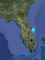
Saltwater, Space Coast North |
|
|
|
This section
lists destinations for Kayaking the Indian
River Lagoon and tributaries from Southern
Volusia County to Northern Brevard County,
including Merritt Island national Wildlife
Refuge and Canaveral National Seashore.
|
|
|
Jump Menu
Canaveral National Seashore
|||
Merritt Island
National Wildlife Refuge
|||
North Merritt
Island
|||
Mainland |
| |
Callalisa Park /
Callalisa Creek
To reach Callalisa Park, take SR 44 east
from either I-95 or US 1 in New Smyrna
Beach. After you cross the high bridge, turn
left at the first traffic light onto
Peninsula Avenue. Callalisa Park is
immediately on the left. Put in here and
head South under the causeway to enter the
creek, while paddling to the North about two
miles will take you to Ponce Inlet.
Callalisa Creek is a tidal creek at the
North end of Canaveral National Seashore
that meanders through Salt Marsh and
Mangrove Swamp. Look for many species of
wading birds, osprey, pelicans, dolphins,
and manatees.
GPS N 29 01.776 W 80 54.215
Google Satellite Image |
| |
|
|
|
Jump Menu
Beachside |||
Merritt Island
National Wildlife Refuge
|||
North Merritt
Island
|||
Mainland
Back to
Top
|
|
There are two distinct
districts with two separate entrances and
you cannot drive between the two. The North
or Apollo District is accessed from New
Symrna Beach in Volusia County while the
South or Playalinda District is accessed
from Titusville.
Owned by NASA, this property is managed
by the National Park Service and protects
roughly 26 miles of Atlantic Ocean Shoreline
and provides nesting grounds for up to 7
species of sea turtles while protecting
natural dunes, coastal strand scrub, salt
marsh and other wetlands, and virtually the
entire body of the Mosquito Lagoon. Over 300
species of birds have been seen at the
seashore from gulls, pelicans, ducks,
herons, egrets, terns, gannets, assorted
shorebirds, and raptors, to painted
buntings, migratory songbirds in the hammock
areas and scrubjays just inside the north
district entrance.
Map of Merritt Island National Wildlife
Refuge and Canaveral National Seashore
|
| |
|
Canaveral National
Seashore North District
|
| |
|
Shipyard Island
Canoe Trail; Mosquito Lagoon;
The northern end of Mosquito Lagoon at
Canaveral National Seashore is a virtual
maze of islands and channels and is a
great paddling destination. In fact,
Outside Magazine rates the Mosquito Lagoon
as one of the top ten paddling destinations
in the United States. A primary feature
for paddling the north district is the
Shipyard Island Canoe Trail. Accessible due
west from the boat ramp located just inside
the North District Gate on the right hand
side of the road, the marked canoe trail
travels through the numerous waterways that
honeycomb this large island, leftovers from
mosquito control efforts in the 1940s and
'50s. Higher than surrounding mangrove
islands, Shipyard Island is shaded with oak
trees, red cedars and cabbage palms.
Oysterbeds, mangrove shorelines, and
seagrass beds abound while designated
backcountry campsites provide overnight,
leave no trace, primitive camping
opportunities in a unique Florida
Wilderness, while white sandy beaches not
accessible by motorboats due to the shallows
invite day picnics.
Shipyard
Island Canoe Trail Map
Map of Canaveral National Seashore
GPS of Boatramp / Launch Site; N 28
56.063 W 80 49.761
Google Satellite Image
|
| |
|
Canaveral National
Seashore South District
|
| |
Eddy Creek
The Eddy Creek area was formed several
thousand years ago when an inlet connected
the Mosquito Lagoon to the Atlantic Ocean.
Tidal currents through this inlet brought
vast amounts of sand and sediment through
the inlet into the lagoon forming a tidal
delta that later became mangrove wetlands.
The inlet later closed, leaving these
wetlands. Here you will find yourself
paddling along mangrove shorelines on
shallow seagrass flats. Wading birds,
pelicans, ospreys, and many other bird and
wildlife species can be sighted from the
seat of a canoe or kayak.
GPS N 28 40.541 W 80 38.884
Google Satellite Image |
| |
Merritt
Island National Wildlife Refuge
|
Jump Menu
Beachside
||| Canaveral National
Seashore
|||
North Merritt
Island
||| Mainland
Back to
Top |
| |
Merritt Island National Wildlife Refuge;
Owned by NASA and home of Kennedy Space
Center, the Merritt Island National Wildlife
Refuge has been managed by the US Fish and
Wildlife Service since 1963. Though there
are four entrances open to NASA workers,
only two are available to provide access to
the public portions of the refuge, and they
are the Max Brewer Causeway in Titusville
and the State Road 3 entrance from US 1 just
south of the town of Oak Hill in Volusia
County. This is a large refuge, 140,000
acres and while there are miles of dike
roads to launch a canoe or kayak from, there
are a few places that stand out from the
rest. These are listed below.
GPS Oak Hill Entrance N 28
50.049 W 80 50.512
Google Satellite Image, Oak Hill Entrance
GPS Titusville Entrance N 28 37.698 W 80
47.288
Google Satellite Image, Titusville
Entrance
Merritt Island National Wildlife Refuge
Map |
| |
|
WSEG Boat Ramp
The WSEG Boat Ramp, located 3.7 miles
north of Haulover Canal, provides access to
Mosquito Lagoon. From the ramp, a 2.5-mile
paddle across the lagoon takes you to a
collection of islands and waterways within
the most remote area of Canaveral National
Seashore, accessible only by boat. Note that
crossing the mosquito lagoon If you like
fishing, large schools of redfish that
congregate in this part of the lagoon are
legendary.
GPS N 28 47.394 W 80 47.260
Google Satellite Image (Boat Ramp)
Google Satellite Image showing islands
opposite boat ramp
|
| |
|
Haulover Canal /
Mullethead Island
The best location on Merritt Island
National Wildlife Refuge from which to view
dolphins and manatees, Haulover Canal is a
passageway between the Indian River Lagoon
and Mosquito Lagoon. Just to the west lies
one of the most significant colonial
waterbird nesting islands in the state.
Mullethead Island and its surrounding grass
flats provide an excellent opportunity to
view a variety of birds from the water's
level. In late spring, there's a good chance
you'll see roseate spoonbills and reddish
egrets feeding their young. Other birds that
nest on the island include great blue,
little blue, tricolored and black-crowned
night-herons; great and snowy egrets; white
ibises; brown pelicans; and double-crested
cormorants. Prime viewing time is March
through July. In addition to wading birds in
spectacular breeding plumage, look for
numerous shorebirds, gulls and terns loafing
on sandbars on the south side of the island.
In winter, lesser scaups, white pelicans,
common loons, red-breasted mergansers and
horned grebes may also be seen on the open
waters of the lagoon.
Haulover Canal is part of the
Intra-coastal Waterway; you never know what
kind of interesting vessels may pass by –
everything from shrimp-boats to tugs and
huge barges to multi-million dollar yachts
utilize the ICW. Bottle-nosed dolphins can
often be seen frolicking near the canal's
approaches, and the deeper waters of the
canal provide shelter for manatees in warmer
months; they can often be easily seen from a
viewing platform near the drawbridge or in
Bair's Cove boat launching area located
southwest of the bridge. Stay at least 150
feet away from the Manatee Viewing Platform
in order to avoid disturbing the manatees.
Going north from the canal, a string of
dredge-spoil islands parallels the
Intra-coastal Waterway in Mosquito Lagoon.
Created in the 1950's and 60's when the
navigable channel was dredged through the
lagoon's shallow waters, these islands have
become wildlife havens; some, like
Mullethead Island, are now important bird
rookeries. With plenty of sandy beaches to
explore, the spoil islands also provide
shelter from easterly winds. It is possible
to paddle from Haulover Canal 10 miles north
to Oak Hill and stay in the lee of islands
the entire way. There is virtually no
development along this spectacular stretch
of waterway. Wildlife is abundant along
mangrove shorelines, and the shallow crystal
clear water allows for great views of
vibrant beds of colorful seagrasses and
marine life. Watch for stingrays, horseshoe
crabs, spotted sea trout, jumping mullet,
and giant tailing redfish in the water and
alligators, wild hogs, raccoons and river
otters along the shores.
Directions: To get to Haulover Canal, go
across the Titusville Bridge and head toward
the Black Point Wildlife Drive. Go past the
Drive to the stop sign at SR 3. Turn left
and go 4.5 miles north, crossing the bridge
over the Canal. Take the first left at the
bottom of the bridge, across from the
Manatee Viewing Platform sign. Follow the
road around, turning right and passing
through a gate at the ruins of the old
Allenhurst Fish Camp. The road now parallels
the canal; go all the way to the end, where
you'll find a nice sandy beach for
launching.
GPS Haulover Canal Launch Point N 28
43.831 W 80 45.689
Google Satellite Image (Haulover Canal
Launch Point)
Google Satellite Image (Mullethead Island)
|
| |
|
Dummit Cove
located 2.1 miles south of Haulover
Canal. Providing access to the Indian River
Lagoon, Dummit Cove is somewhat sheltered
and can be an interesting place to visit on
windy days when paddling on the open waters
of the lagoon becomes difficult. Following
the shoreline of this cove makes a great
paddling loop trail. You will find many
species of birds here and possibly an
alligator or two. Seagrass beds here are
very lush.
GPS N 28 42.589 W 80 44.090
Google Satellite Image
|
| |
|
Max Brewer Causeway
Max Brewer Causeway or State Road 406
from Titusville is a good place to put in to
explore the refuge by kayak. Putting in on
the north side of the causeway allows you to
explore the western shoreline of the refuge
up to the Pucket Creek Area.
Put in on the south side of the causeway to
access Gator Creek, Brock's Point and
Peacock's Pocket near the mouth of Banana
Creek. This is the closest area on the water
from which to view Space Shuttles take off
and land; the launch pads are just nine
miles from the mouth of the creek, and the
landing strip is 2.5 miles away. Banana
Creek itself is closed to the public as it
is within NASA'a Kennedy Space Center
Security Zone. Do not Enter even the
mouth of the creek.
GPS N 28 37.621 W 80 47.365
Google Satellite Image (Launch on either
side of causeway at green arrow)
Google Satellite Image Gator Creek / Catfish
Creek (Catfish Creek marked by arrow,
Gator Creek is just north. Both are OK to
enter)
Google Satellite Image of Banana Creek (Do
Not Enter, NASA Security Zone)
|
| |
|
|
| |
|
Jump Menu
Beachside ||| Canaveral
National Seashore |||
Merritt Island National Wildlife Refuge
||| Mainland
Back to
Top
|
| |
Pine Island Conservation Area;
The Pine Island Conservation Area is a
dynamic landscape supporting a diverse plant
community and abundant wildlife. Adjoining
the Merritt Island National Wildlife Refuge,
the 879-acre conservation area is jointly
owned by the Brevard County Environmentally
Endangered Lands Program (EEL Program) and
the St. Johns River Water Management
District. Two hiking trails accessed from a
trailhead 0.5 miles from the entrance
parking area offer moderate 1.0 mile and 1.5
mile walks through pine flatwoods and hydric
hammock habitats. Each trail features
overlooks providing visitors with panoramic
vistas of shallow water feeding habitat of
wading birds, shorebirds and waterfowl.
Biking is allowed on established trails.
Two canoe trails, a
2.3-mile loop run and a 3.0-mile run, offer
a relaxing way for visitors to observe area
wildlife. Canoes may be launched from the
Marsh Pond or Sam's Creek launch sites.
During low water periods a natural channel
connecting the north marsh ponds is
impassable. A depth gauge located at the
Marsh Pond canoe launch indicates when water
depths in the ponds hamper navigation.
Boating is restricted in the south end of
South Borrow Lake. This area provides
critical nesting habitat to a variety of
wading and diving birds. Human disturbances,
although unintentional, can result in the
loss of young hatchlings. The coastal
location and diversity of habitat types
provide many opportunities for viewing
wildlife that are enhanced by permanent
blinds accessible by foot or canoe. Wading
birds are common, with fall migration
bringing numerous species of waterfowl and
shorebirds, as well as white pelicans that
feed and rest in shallow waters of the marsh
pond and the Indian River Lagoon. Pine
flatwoods provide habitat for resident and
migratory songbirds. Red-tailed hawks,
ospreys, and black vultures are often
sighted, and occasionally bald eagles are
seen soaring over the conservation lands.
Alligators and aquatic turtles are also
common inhabitants of the marshes and
expansive open waters. Endangered manatees
frequently seek refuge in the peaceful
waters of Sam's Creek/Rinker Canal. They are
often observed resting at the north end of
the canal, particularly during winter and
early spring months.
Directions: From the
intersection of SR 520 and SR 3 (North
Courtney Pkwy) on Merritt Island, go north
on SR 3 for five miles to Pine Island Road.
Turn left and go west on Pine Island Rd. and
follow it 2.5 miles to the parking lot at
the end. A kiosk with a map shows the canoe
trails. For information, visit
www.eelbrevard.com, or call 321-255-4466.
Google Satellite Image
|
| |
Kaboord Sanctuary
Kaboord Sanctuary is another one of the
Brevard County Environmentally Endangered
Lands Program properties. Central Florida is
unique in that, geographically, it lies in
an area where temperate and subtropical
climatic zones meet. This site represents
one of the best examples of the mixture of
tropical and temperate species of plants for
which Merritt Island is famous. The tidal
creeks of Kaboord were once part of the
Sykes Creek system before they were
impounded. These beautiful wetlands are
reminiscent of what much of Merritt Island
used to look like, a "savannah" of salt
grasses and low mangroves. The paddling
route is down the main creek channel, with
detours along side creek channels along the
way, terminating at the dike at Canaveral
Barge Canal. The return trip will retrace
the same route, but don't worry -- wildlife
moves around, the angle of the sun changes
perspectives, and you won't be bored
paddling back. This wetland is known for
numerous birds -- raptors, waders,
shorebirds, gulls and terns and some
early-arriving waterfowl. There is no
motorboat access to this site, so be
prepared for a peaceful ride!
Directions: To get to
Kaboord Sanctuary from the intersection of
Highway 528 and SR 3 (Courtenay Parkway),
proceed north on SR 3 for about two miles.
Make a right on Hall Road at the Circle K.
You'll see a sign for NASA's KARS Park. Go
east on Hall Road to where the tree line
ends at the western edge of the open marsh.
GPS N 28 26.057
W 80 41.757
Google Satellite Image
|
| |
|
|
|
Jump Menu
Beachside ||| Canaveral
National Seashore |||
Merritt Island National Wildlife Refuge
|||
North Merritt
Island
Back to
Top
|
Spruce Creek Park;
6250 Ridgewood Ave. Port Orange
386-322-5133
A natural blackwater stream, Spruce Creek
enjoys an Outstanding Florida Waterways
designation due to its relatively pristine
condition. There are few examples of this
type of river left undisturbed in Florida.
The term "blackwater" refers to tannic acid
staining caused by swampy vegetation in the
low-lying upper reaches of the creek. The
navigable portion of the creek itself begins
in a shallow cypress swamp some 10 miles
upstream from its confluence with the
Halifax River. This swamp gives way to a
narrow stream that very gradually broadens
downstream into Strickland Bay. As the water
courses toward the coast, the associated
aquatic habitats gradually change from
typical freshwater hardwood forest to
freshwater marsh to mangrove shorelines and
salt marsh in a classic estuarine ecosystem.
The biological diversity and contrast
between upstream and downstream habitats in
the Spruce Creek watershed make this river
an extremely unique natural area that
supports a tremendous amount of wildlife.
Historically, a large indigenous Native
American habitation was nestled around the
Spruce Creek basin. One of the largest
prehistoric earthenworks in Florida, the
Spruce Creek Mound, is located on the creek
on a high bluff. The site functioned as a
major ceremonial and political center for
the Timucuan Indians. Lesser mounds are
scattered throughout surrounding areas.
Directions: From the
intersection of SR 44 and US 1 in New
Smyrna, go north 4.8 miles on US 1. There is
a sandy beach on the east side of US 1, just
south of a bridge. From the launch area, go
under the bridge and paddle west through
Strickland Bay to enter Spruce Creek or
south to enter Turnbull Bay, a large
estuarine area. You can paddle east through
the mangrove islands to reach the Halifax
River, from which it is about a 1.5-mile
paddle south to reach Ponce Inlet. Nestled
under tall pines just northwest of the US 1
Bridge, Spruce Creek Park has rest rooms,
picnic tables, nature trails and a camping
area. There is a canoe launch next to the
park's fishing pier, however boats must be
dragged quite a distance and it is unusable
at low tide (too much mud). It is much
easier to launch from the sandy beach off of
US 1. This site is south of the park
entrance. If approaching from the south the
launch site will be on the right just before
the first of three small bridges taking US-1
across the Creek to the park.
GPS N 29 05.673 W 80 58.270
Google Satellite Image
GPS US-1 Launch Site N 29 04.947 W 80
57.825
Google Satellite Image of US-1 Launch Site
|
| |
River Breeze Park
Volusia County's Riverbreeze Park is the
closest launch for access to dozens of
islands that fill the waterway from Oak Hill
northward to the New Smyrna Beach Causeway
and beyond. From the boat ramp, paddle south
to get around a large spoil island and into
mangrove-lined backcountry waters. Low tide
exposes mud flats and oyster bars that in
fall, winter and spring attract a wide
variety of wading birds and shorebirds;
American oystercatchers are fairly easy to
find. Dolphins and manatees are commonly
seen in the deeper waters of the
intra-coastal waterway. A compass is helpful
as it is easy to become disoriented in the
puzzling maze of waterways found here. This
beautifully shaded park has bathrooms,
picnic pavilions and several boat ramps.
Camping is permitted.
Directions: To reach
Riverbreeze Park, go north on US 1 two miles
from the yellow caution light in Oak Hill.
Look for a brown sign identifying the park.
Go east to the park entrance on the left.
Visit volusia.org/parks/riverbreeze.htm or
call 386-345-5525 for information.
GPS N 28 53.719 W 80 51.239
Google Satellite Image
|
| |
|
Turnbull Creek
Turnbull Creek can be found just North of
the Brevard County line in Volusia County on
US-1 between Scottsmoore and the Town of Oak
Hill. Heading south on US-1 you will pass
the merge between SR-3 and US-1, then cross
a bridge over a railroad track. Just south
of the bridge the highway crosses Turnbull
Creek on a level bridge. It is fairly easy
to miss until you're right on top of it, so
slow down real soon after the railroad
bridge. Here is where you put in. From the
South, you will see the railroad bridge
before you see the bridge over the creek
soon after entering Volusia County. If you
cross the raised bridge over the railroad
tracks you have gone about half a mile to a
mile too far. After putting in at the US 1
Bridge, you have two choices, into the swamp
(North) or towards the Lagoon (South).
Paddling to the north takes you from the
beginnings of the salt marsh habitat near
the bridge, and rapidly the vegetation
changes to a more freshwater environment.
There will be a point where the treeline
seen across the marshgrasses merge across
the creek, but there is an small opening to
fit through. Then the scenery changes
dramatically. You find yourself in a narrow
creek and shaded by trees growing from the
wetlands until the creek opens into a most
beautiful pond. The pond itself does not
seem to have a channel leading into it.
Paddling south from the US-1 put in point,
the current slows, the creek widens, and the
habitat is definitely becoming salt marsh.
This is a birdwatchers paradise! White
Pelicans, Egrets, Herons, and other
waterbirds are in abundance. This is one of
the last truly pristine salt marshes left in
the entire Indian River Lagoon system
unaltered by man. This is a very relaxing
paddle and a chance to experience one of the
lagoon system's most unique habitats.
GPS N 28 49.232 W 80 51.593
Google Satellite Image (US-1 Launch Point)
Google Satellite Image (North Channel)
|
| |
|
|
|
|